Esseillon Barrier - Fort Charles-Felix
Fort Charles-Felix
Signs recommend against visiting this fort due to danger. Not
only is the fort next to a cliff, the fort was partially destroyed and
in places appears to be on the verge of collapse. The warning is
entirely reasonable, but I and others have visited at our own risk.
Fort Charles-Felix was the most compact of the forts and was garrisoned
by 150 men, intended to defend a bridle path to the village of Aussios.
As part of the treaty that transferred the area to France,
Napoleon III
agreed to destroy the forts, but he never intended to fulfill his
obligations. This, the smallest and least
important fort, was only partially destroyed and even then in such a
way that it could potentially be put back into service if needed.
The destruction at times make it difficult to make full
sense of the fort,
but in other places it is like walking into a cut-out model! It
is a truly unique experience.
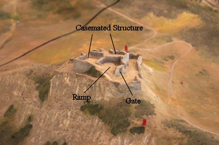
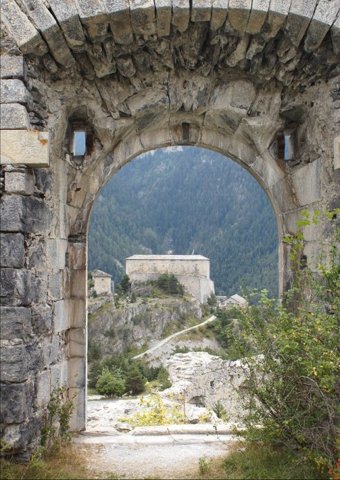
In the model pictured above, the visible opening is the gate. Not
shown in the open area behind the gate is a ramp. Behind the
open area is the two story casemated structure.
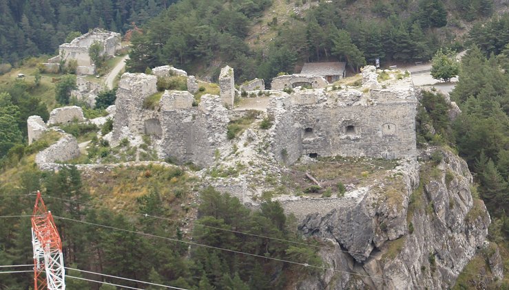
Fort Charles-Felix From Fort Marie-Christine
Fort Charles Felix from near Fort Victor-Emmanuel
Entrance from the Parking Area
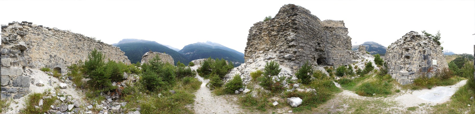
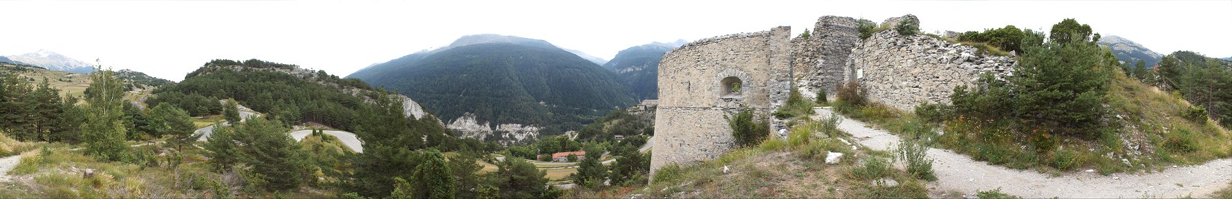
First we'll walk down the trail in the left-center of the panorama for
a peek then return and climb through the tempting hole in the wall
visible at right-center.
The walls have been lowered, which helps make some sense of the
drawbridge to nowhere. At right-center of the panorama you can see
the abutment that the bridge rested on. See photos below.
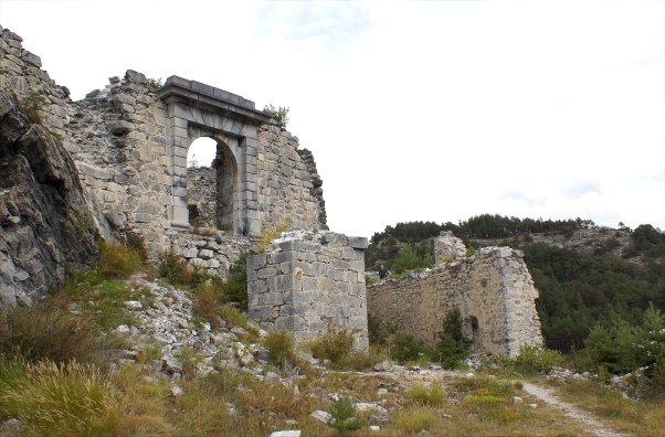
Gate
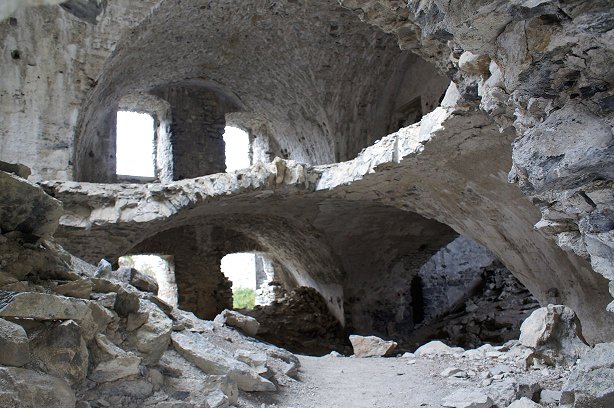
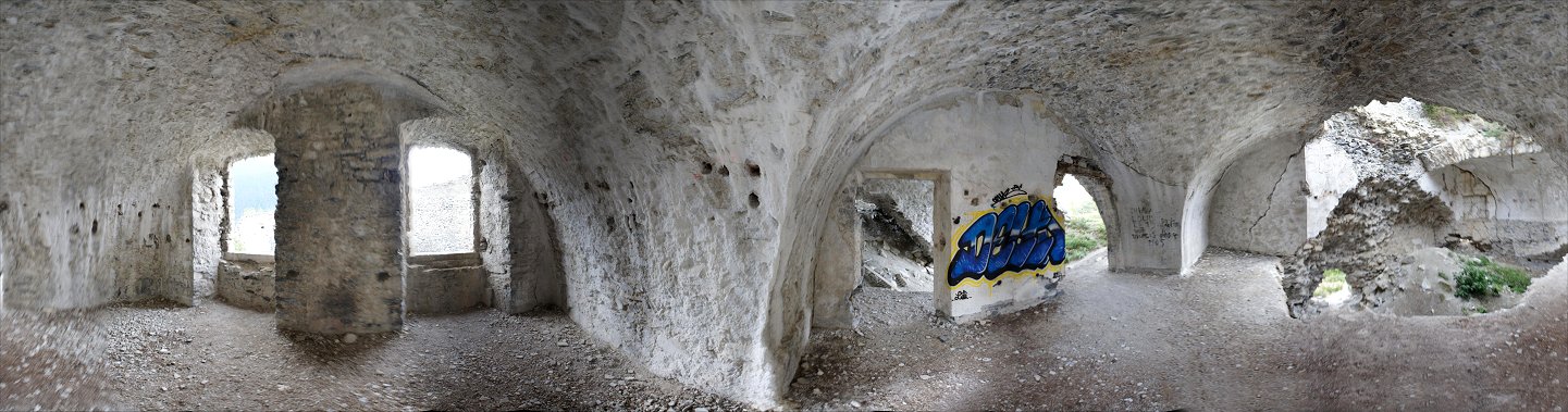
Returning to the inviting hole in the wall, we enter the multi-story
polygonal portion of the fort. The damage reveals very nicely an
interior view that you are unlikely to find anywhere else.
You can get a good idea of the overhead protection in this view.
The lower level is filled with rubble from above.
Although it may appear that we can climb up to the upper level,
it is more difficult than it appears, so let's...
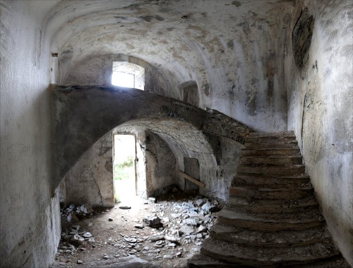
...find the stairs.
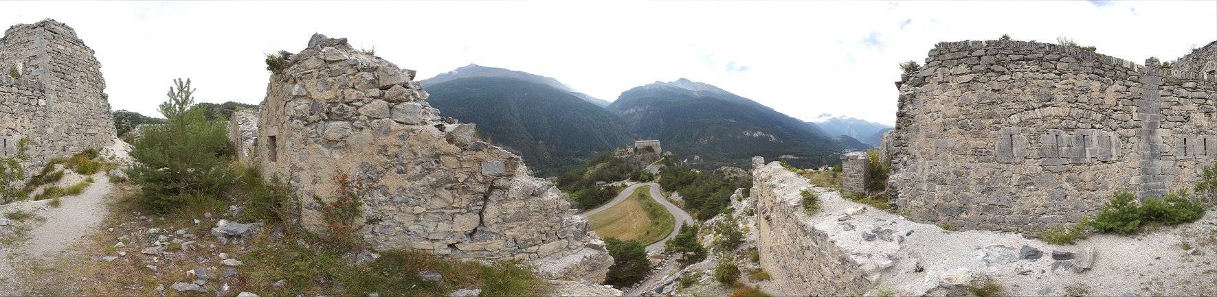
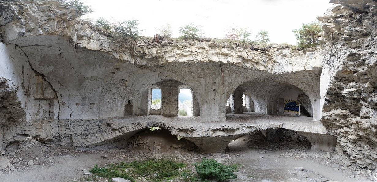
Upper Level - 360 Degree View
At right is the damaged area that we have previously seen with no roof.
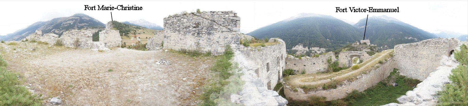
From the top you can see that the walls once continued higher, and it
appears that a sloped roof covered this area. Like Redoubt
Marie-Therese, rooftop mortars could be installed, and perhaps this is
the location. At right you can
see the ramp to the gate - You can consult the model to get a good
understanding of where we are.
Fort Victor-Emmanuel is
visible just above the gate. On the opposite side of the
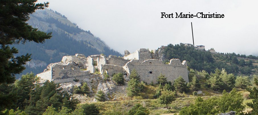
panorama, Fort Marie-Christine sits atop the cliff.
Copyright 2015, John Hamill