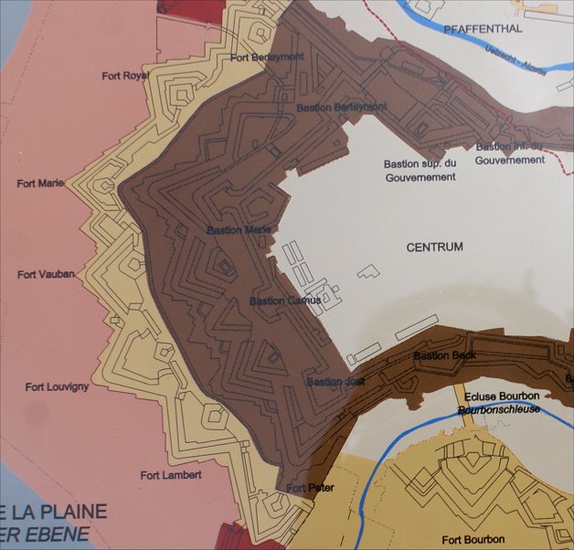
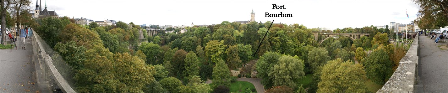
Fort Bourbon From Bastion Bock
Looking East. Note casemates in rock below walls.
Looking West
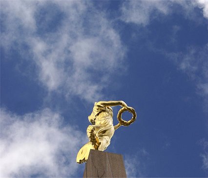
World War I Memorial in Bock Bastion
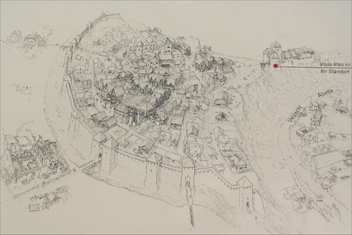
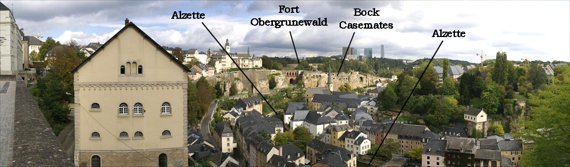
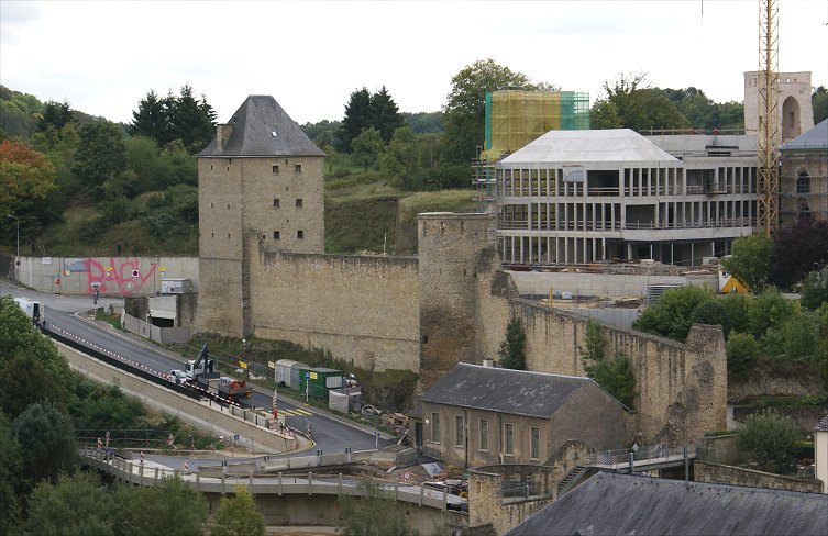
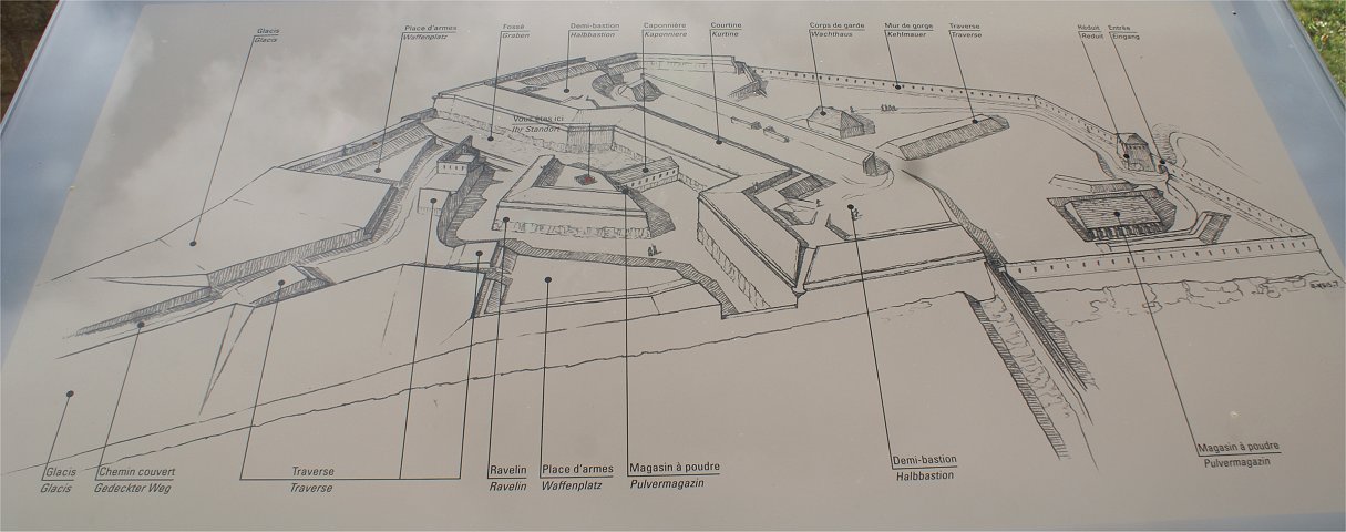
| Built atop rock cliffs, Beck Bastion
looks south across a tributary of the Alzette. The ruins of Fort
Bourbon, designed by Vauban, can be seen across the valley. The
defenses on the less easily defended west side of town, an interesting
and complex system, has been largely developed over, and there is
little to see now. |
|
Fort Bourbon From Bastion Bock |
Looking East. Note casemates in rock below walls. |
Looking West |
World War I Memorial in Bock Bastion |
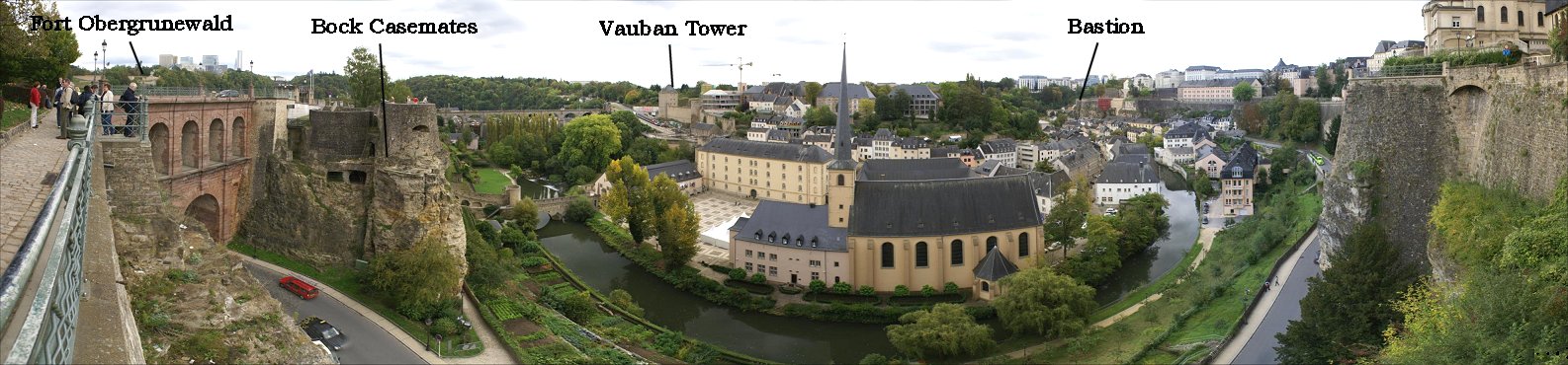
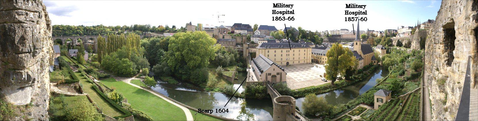
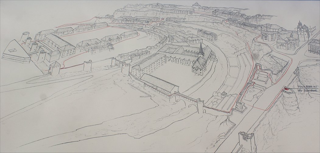
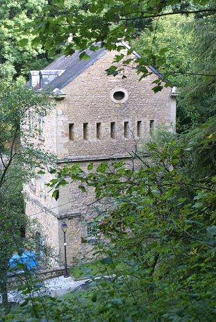
| From Bock Casemates you can see the old medieval wall, later modified, crossing the Alzette then pivoting and climbing uphill to Tower Jacob. In the 19th century a military hospital was built in the bend of the river next to an abbey. |  |
 Tower Jacob |
 |
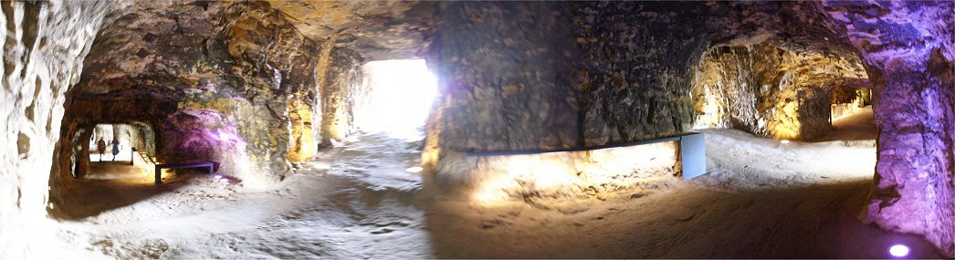
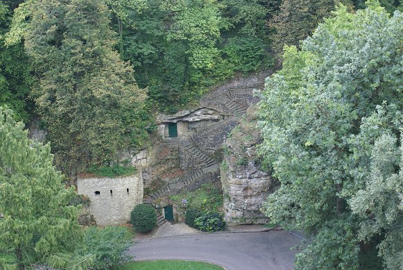
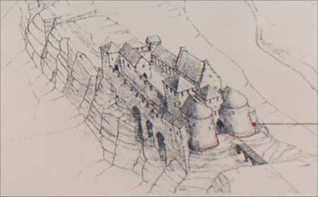
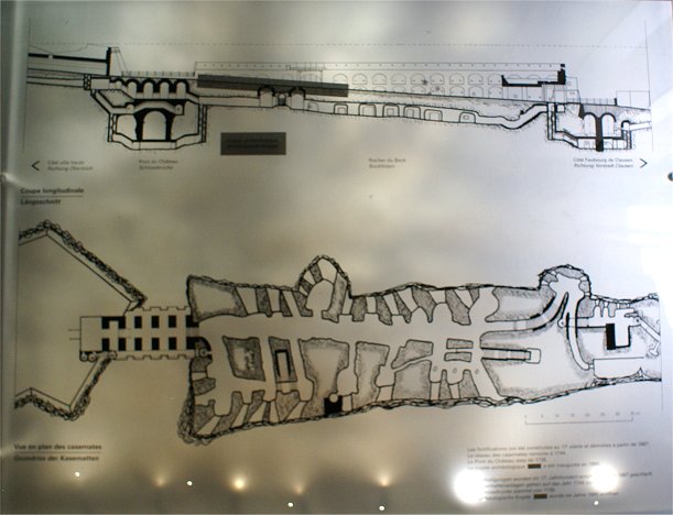
| The first casemates were dug in 1644 while Spain controlled
the city.
After the capture by Vauban, the underground works were
continued, and after takeover by the Austrians, construction
continued further.
A fort in three sections was on top of the casemates, no longer
in existence, making the ridge a formidable artillery platform with 50
guns dominating the valley below. The tunnels extended to such an extent that when Luxembourg was neutralized in 1867, it was impossible to destroy the tunnels without endangering the city's buildings above. In the Second World War, the casemates were used as shelters for civilians. Despite the strength of the Bock position, Vauban smashed the fort during his 1684 siege with artillery on the heights across the river. Given the opportunity to enhance Luxembourg's defenses after the war, he added works on these heights and also on the Rham Plateau. |
 |
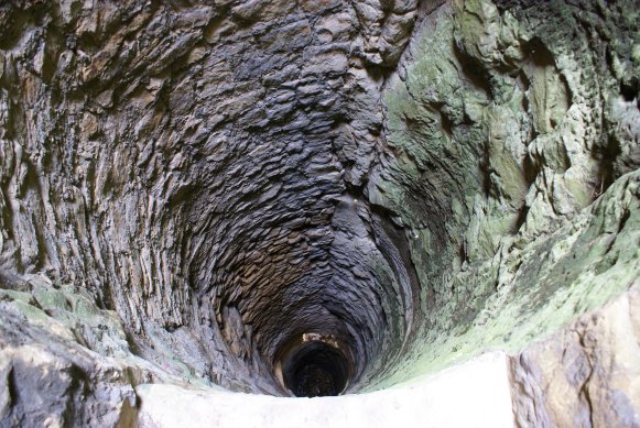 Well |
 |
 |
 |
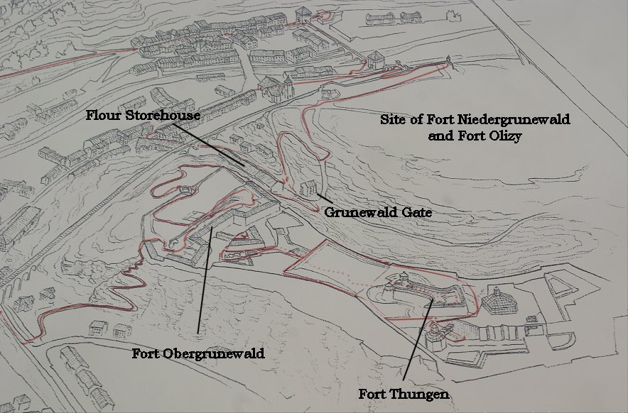
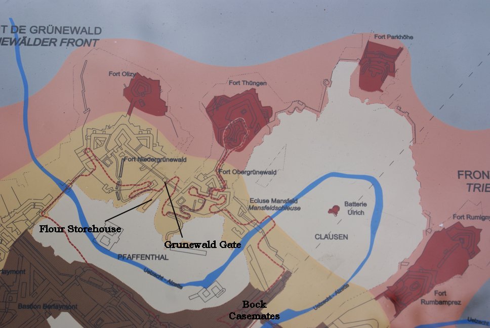
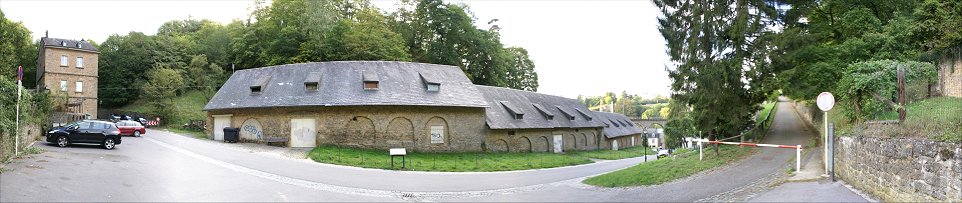
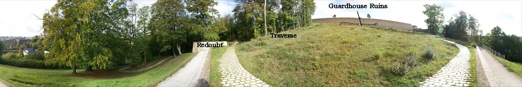
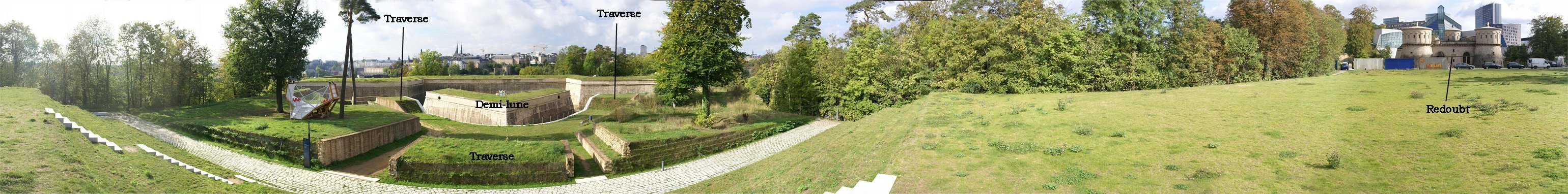
In the panorama above, the three part tiered building at
center was designed to store the garrison's supply of flour, built originally of wood in 1733 by the Austrians in Hiel. valley. The flour was preserved barrels to protect it from insects and mice. In 1771 the building was renovated with masonry. The appearance of building here today resembles the time period between 1815 and 1866. On the left of the panorama, the tall building is the Grunewald Gate. This gate was originally built in 1685 with a ditch and loopholes. An infantry defense tower, on either side were walls with loopholes fronted by a ditch. The wall connected the city's inner defenses with those on the high ground across the Alzette. Gated towers like this were designed to strengthen the connecting wall. The walls on either side of the tower have since been demolished, and the present tower approximates its 1836 appearance as modified by Prussian engineers. Next we walk up a path to Fort Obergrunewald. |
|
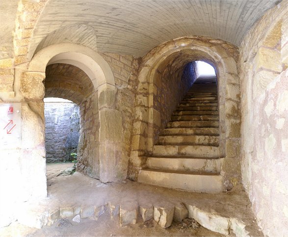
We have walked up the paved path at left from the
Grunewald Gate and have entered the rear of Fort Obergrunewald. The
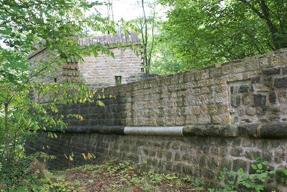
fort 's corner can be seen in the photo at right, which suggests that
the wall is not restored to its full height. Within this corner
was a powder magazine, built in 1860 but no longer extant. After
angling back, the wall continues to the main fort. At this
junction, another wall descended into the valley to the Grunewald Gate. Where we are standing was a redoubt - a bomb proof vaulted tower which served as a refuge for soldiers when under attack or bombardment. The redoubt also allowed fire from its casemates to cover the walls on either side. Next we continue along the path uphill and into the fort. |
 |
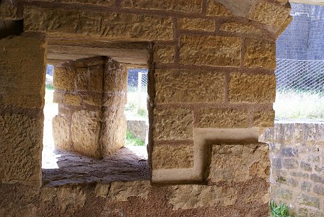
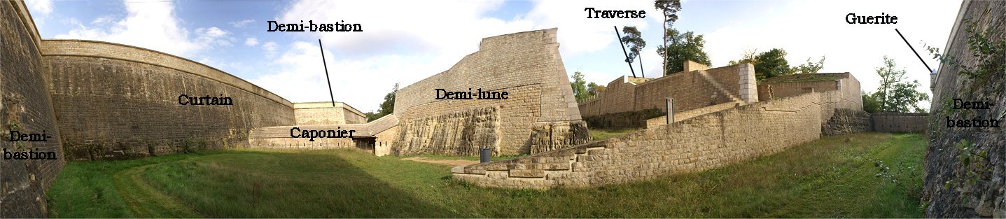
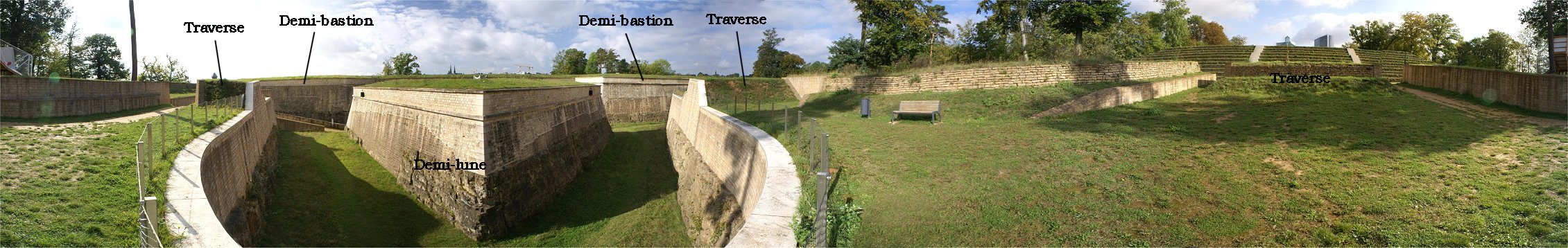
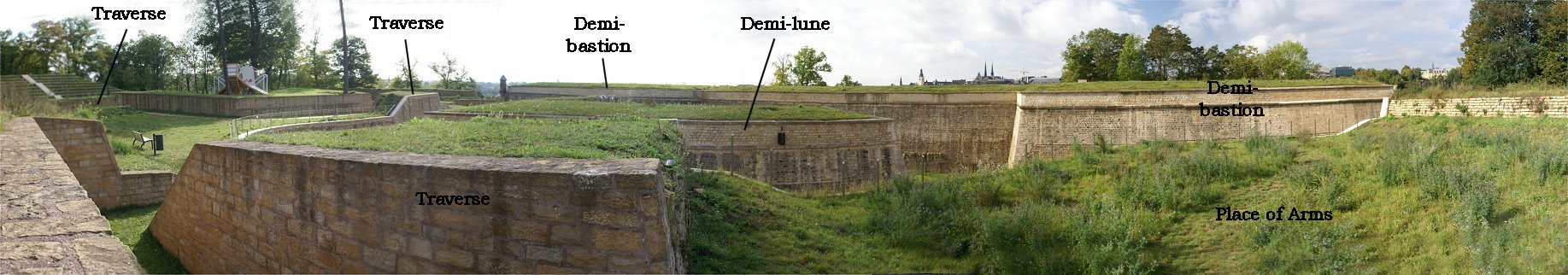
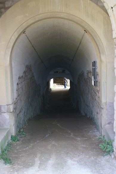 |
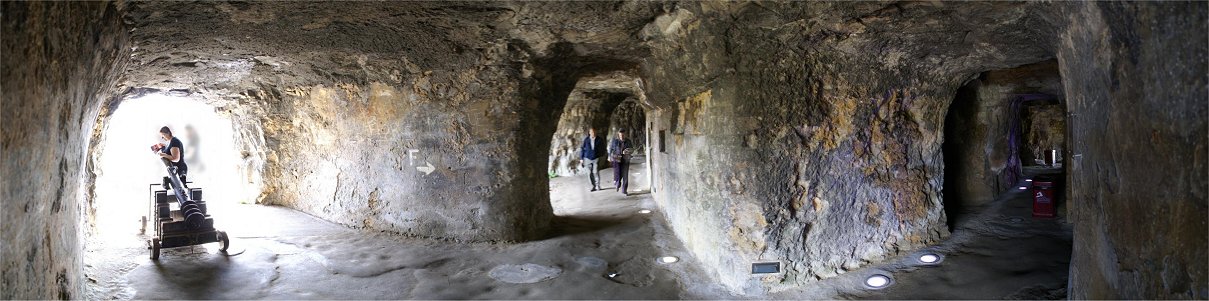
This is looking along the length of the underground passage. Barely visible on the far sides of the photo are stairways up to the top of the fort. You can see the passageway level off; this is the caponier. At the end, stairs climb to the demi-lune, and the man that you see is facing an opening into the ditch. |
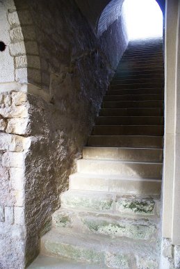 |
At far left is where we entered. This is looking left up the stair to the top of the fort. |
 |
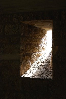
This is the end of the passageway. At left is a passageway that once led to a small powder magazine which could hold about a day's worth of powder. The stairway climbs up to the demi-lune. |
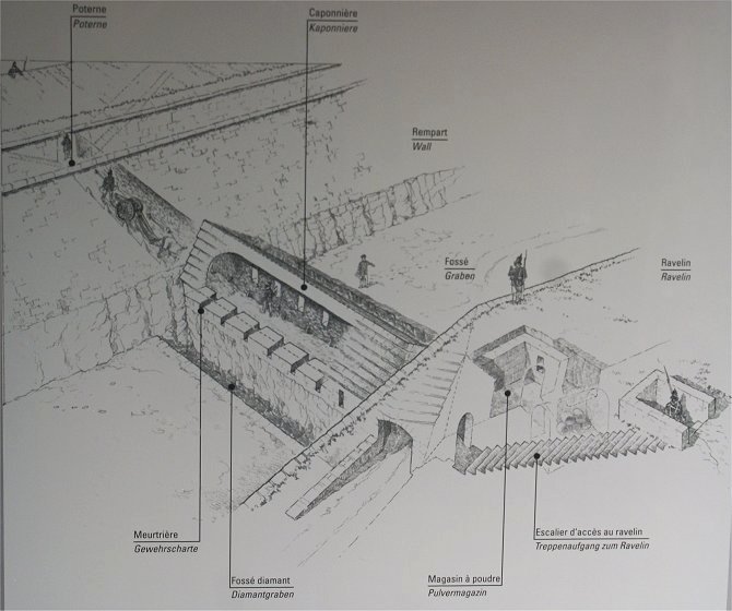
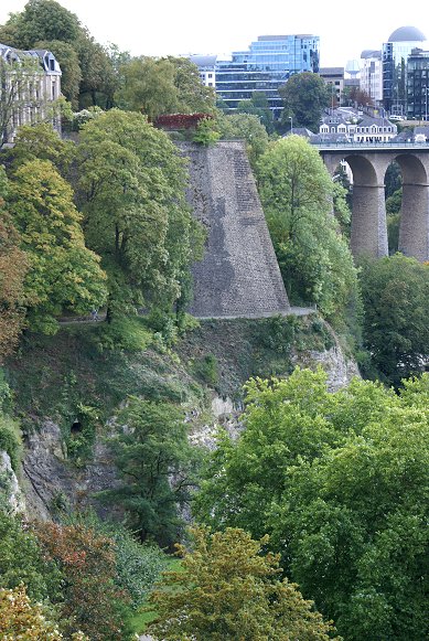
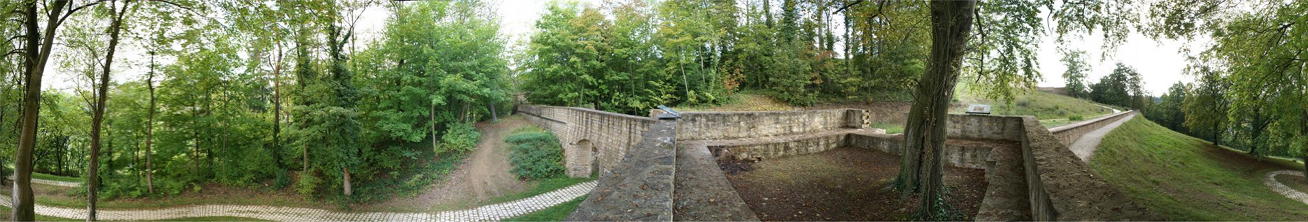
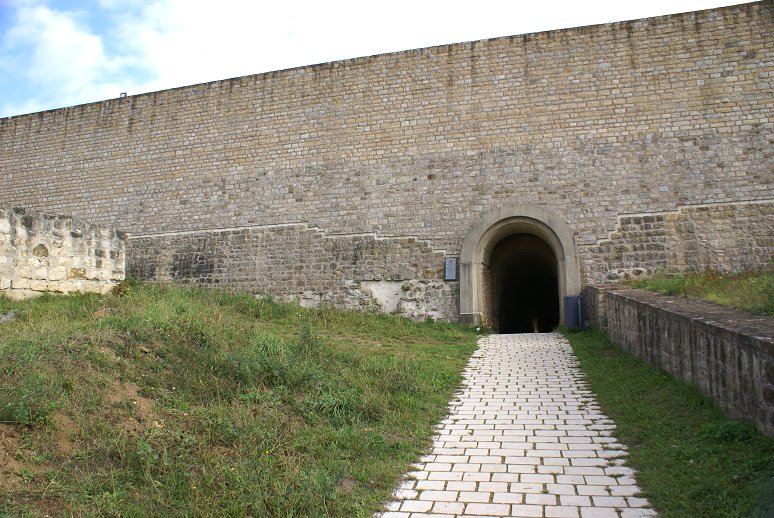
| The covered way is about six meters wide and two meters below the crest of the glacis, the open field of fire, in order to provide protection against enemy fire and observation. The soldiers were positioned in ranks, and to be able to fire, they had to stand on the slightly raised ground in order to raise themselves up enough to fire. | 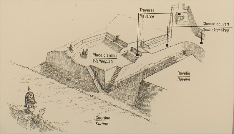 |
|
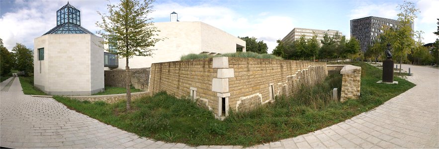
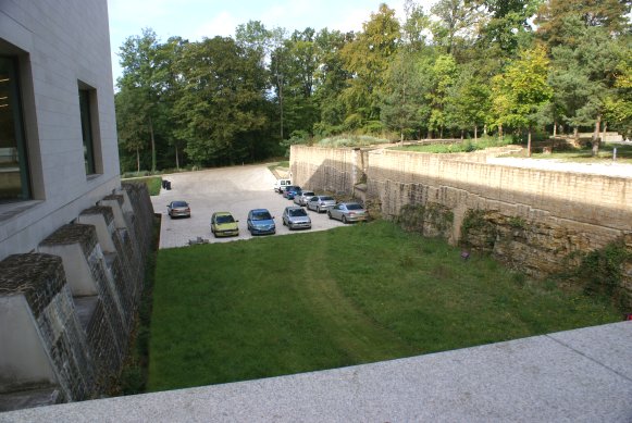
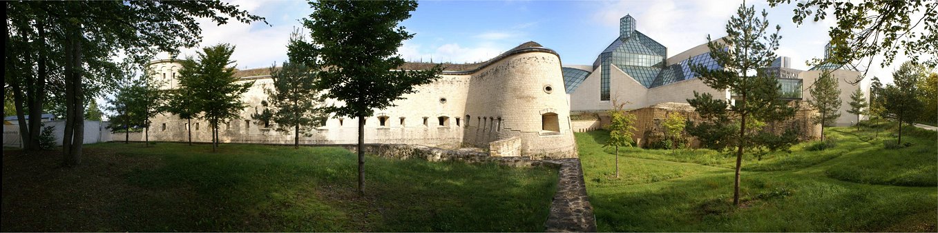
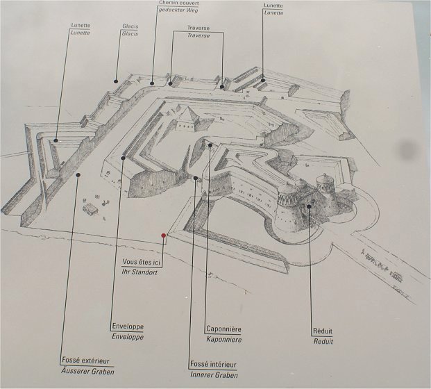
Redoubte du Parc was designed and built by Vauban in 1688. That is what we see here - but with a modern art museum atop it. In 1726, Austrian Major General Simon Beauffe was ordered to Luxembourg to direct the extension of the fortifications. In 1730 he wrote that he could quickly perfect Vauban's redoubt, and he developed plans for a third defensive line made of seven outworks. These bombproof outworks were not in a strict defensive line but rather were several hundred meters apart and designed to mutually support each other. These types of works marked the end of the bastion system that had dominated fortification since the 1500s. |
 |
|
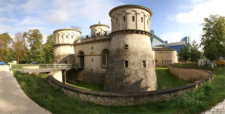
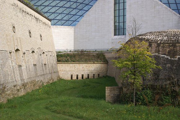
The Prussians modified Fort Thungen in the 1830s. Note decorative acorns atop the towers. Initially, the entrance to the Austrian redoubt was very narrow and was located almost at entrance of the system of mines. During upgrades of 1836/37 the Prussians raised the level of the interior of the redoubt and partially filled the ditch. A stone foundation was built in order to hold up the larger bridge piers. According to the plans of 1821, the drawbridge had to be designed so it could be be raised and lowered by hand. The deck of the drawbridge, weighing about 600 kg, can be moved up or down by two people thanks to a system of thirteen counterweights of 21 kg each on the chains on each side. When the bridge deck is lifted, the counterweights support human effort, while on the way down, they serve as brakes. |
 |
 |
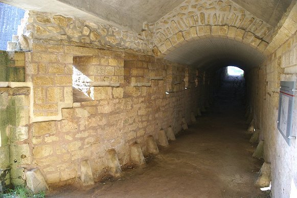
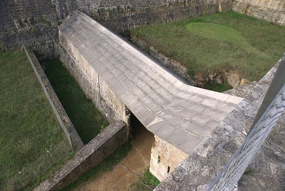
 Caponier Connecting the New with the Old |