Brandywine
Second and Third Lines
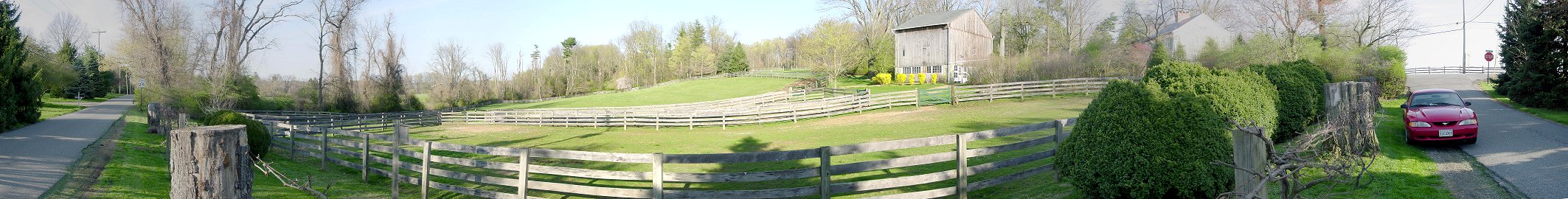
K) Second Line
Remnants of the three American divisions were forming on a hill just south of their first line. Here, roads from the east and west intersected with Birmingham or Forks Road just below the hill. This is the view of the hill from the eastern road.
Stephen's Division composed of Scott's and Woodford's Brigades were withdrawing down Birmingham Road and about to pass the forming second line. Then, fresh British troops who had overlapped the right of the American first line slammed into the retreating Virginians. In his first battle and without a command, 19 year old Maj. Gen. Lafayette desperately exposed himself to enemy fire to rally and encourage the men. He was wounded, but his actions inspired Washington's admiration and affection, and he was later given a division.
The British units, the 2nd Light Infantry Bn., the 4th Brigade, and jagers engaged in hand to hand combat, some of the fiercest and costliest fighting of the battle, and drove the Americans from the field.
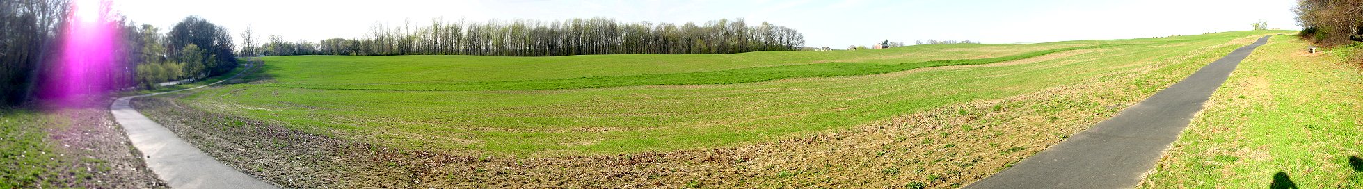
L) Sandy Hollow - Halfway Down
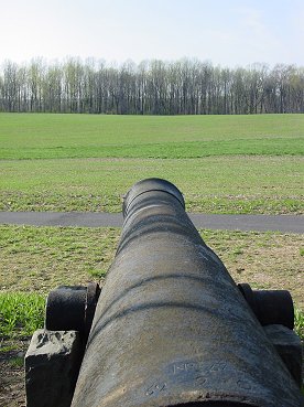
Cannon Pointing to Area of Most Intense Combat
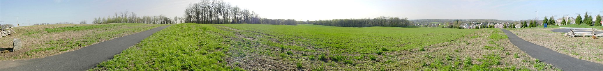
M) Sandy Hollow - Top of the Hill
The situation now looked grim as the three American divisions were in disorganized retreat. Washington had ordered Nathaniel Greene's division from reserve to reinforce Sullivan. In a remarkable march, or probably more accurately, a remarkable jog, the men covered four miles in 45 minutes and deployed to cover the army's retreat.
Samuel Stella Smith's impressive book shows this rearguard action as occurring south of Dilworth, far from this location, but the conventional interpretation is that it occurred here at the new Heritage Park, which protects at least this particular portion of the battlefield from the steady advance of McMansions and other desecrations to our history.
Greene's two Virginia brigades under Weedon on the left and Muhlenberg on the right, along with some men Sullivan had rallied, protected a choke point called Sandy Hollow, a worn down section of the road. The modern road is in a different location, but the old road and choke point can be approximately found by looking down an enormous Civil War cannon along the paved trail. The American line checked the British advance until the British brought up two cannon and forced the Americans from the field. At that point, the day was drawing to a close, and Washington's army was in retreat.
Important Note: Ed Wimble, designer of 1777: The Year of the Hangman, a wargame from Clash of Arms, e-mailed me the following on 6/16/04.
"Tom McGuire just a few weeks ago gave a talk on a map he recently discovered in England drawn by one of the British officers who participated in the battle. In the positions shown on it Greene's last ditch stand is much closer to the intersection of modern Routes 202 and 1 than earlier believed - in fact, further south of Dilworthtown, near the Wawa where Old Wilmington Pike intersects 202. You'll note that this is just south of the old Brinton 1704 House where I place it as occurring in http://www.clashofarms.com/brandy-ger.html.""That cannon in your picture (Sandy Hollow) is near where Conway had his stand, but he was more to the left. Through the new development there, in the middle of the pasture of the original farm from which it was gouged, is the tree marking the site where LaFayette was wounded. The old tree blew down in a hurricane several years ago. There is an interesting story of how the family living there would not allow the LaFayette monument to be placed on their property, but they would let a tree mark the spot. The monument was then placed in its current location just to the north of Sandy Hollow. This tree is difficult to locate because the family currently living there exhibit hostility toward trespassers... Beware of Dog signs, that sort of thing."