Cabourg Draw


From Colleville Draw

On the beach toward Cabourg Draw, just before where the bank became a cliff, several tanks landed.  Beyond them, Company L, 16th Regiment, or rather 5 of their 6 boat teams, landed half an hour late at 7:00am facing the cliff.  Meanwhile Company I, 16th Regiment in their LCAs were paralleling the cliffs coming this direction, trying to find a landing spot after overshooting to the east, like many other units that morning.  They would land around 8:00, an hour an a half late.  Most of the 16th Regiment would come ashore farther east than intended and in groups over time, not in a uniform line as intended.  

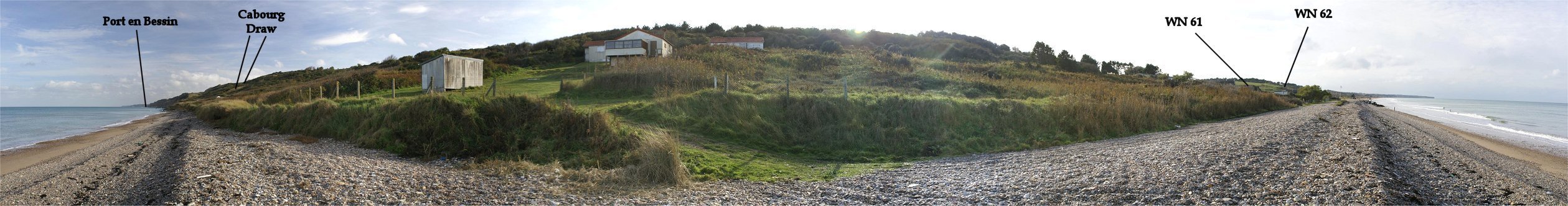
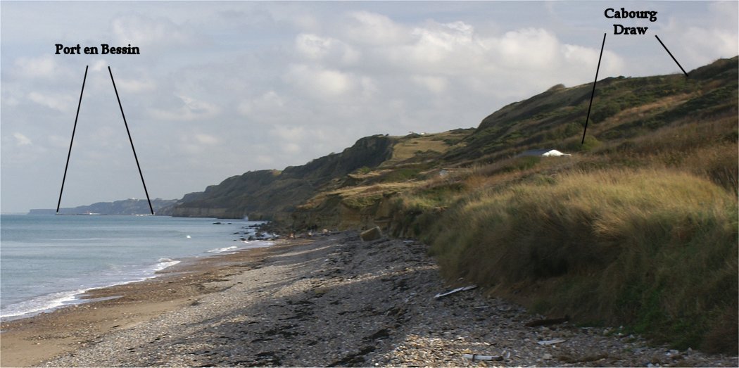
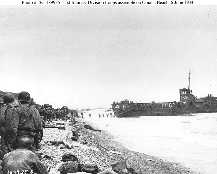
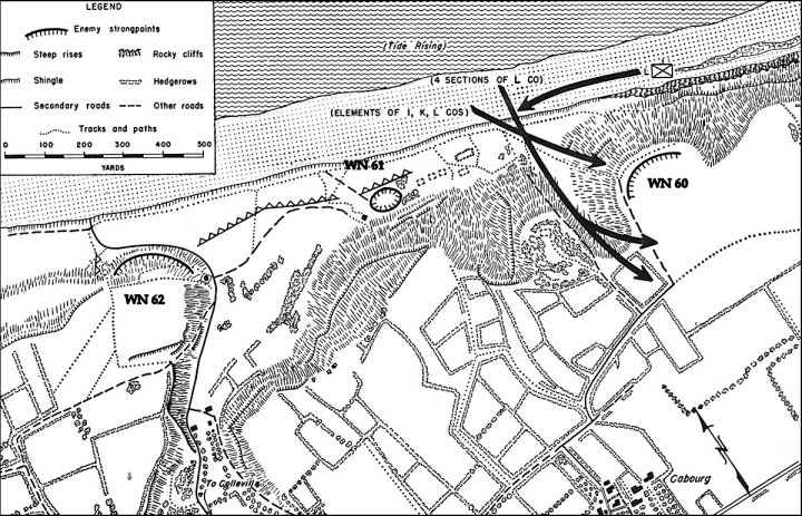
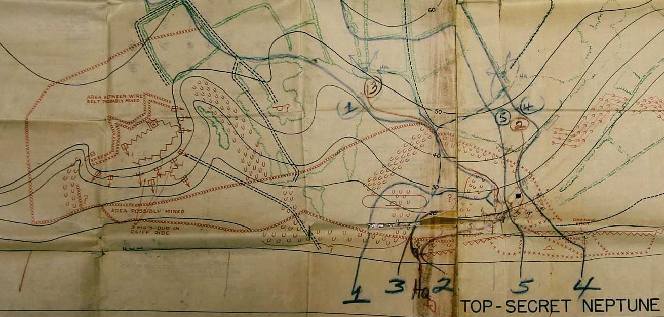
WN 61, defending Colleville Draw, was unusual among German strongpoints in that it was on much lower ground, only about 40 yards from the beach.  It contained an 88mm gun facing toward Colleville Draw.  At H-Hour, men from Company E, 116th Regiment, 29th Division came ashore in four LCAs just beyond WN 61.  Cpt. Maddill, the company commander, was soon wounded and the men were pinned down.  Amost directly in front of WN 61, three LCVPs landed with men from Company F, 16th Regiment.  To their right, five LCVPs landed with men from Company E, 16th Regiment.  All these men were pinned down.  Eventually, however, things started to change.

Staff Sergeant Frank Strojny, seeing that his officers were out of action, ordered the men around him to shift left for better cover.  He saw the 88 in WN 61 take out three American tanks.  He found a bazooka and several rounds.  Despite the bazooka being damaged, he fired it into WN 61 anyway.  The last of his six rounds detonated ammunition, putting the position out of action.  Strojny suffered a slight head wound from sniper fire.

Stroyny lead men forward, blowing the wire and advancing  through a minefield uphill, killing several Germans.  The action here, and at Cauburg Draw, helped the Americans open up Colleville Draw.
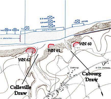
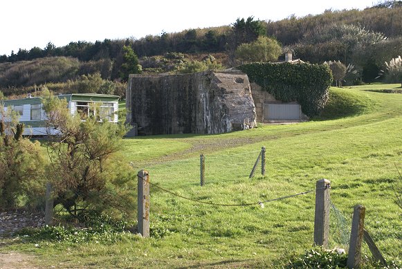
WN 61


This is a panorama and a zoomed section of it from between Colleville Draw and Cabourg Draw.


This is the area that Company L, 16th Regiment landed.  Facing cliffs, the company shifted right, to where the cliffs became embankments, which were shorter and less steep.  Blowing holes through the wire atop  the embankments, several assault sections went over the top.


These are photos from the approximate location on D-Day.


From atop these small cliffs, you can see Port en Bessin and some of the remains of the Mulberry Harbor at Arromanches.


This is the view from just atop the cliffs.  The gravel road where my friend is walking, I believe, heads up Cabourg Draw.  Beyond the buildings, I believe, was the German strongpoint WN 60.  As the attack developed, the company commander, Cpt. Armellino, was wounded trying to coordinate with the tanks on the beach.  USS Doyle also provided fire support.  The attack continued, despite the captain's wounding.  Lt. Jimmie Montieth led one of the assault sections.  He, like his wounded captain before him, coordinated with the tanks, then lead his section forward through the wire, enemy fire, and minefields.  He would be killed that day and was posthumously awarded the medal of honor.  He is buried in the Normandy American Cemetery.  WN 60, which had a good field of fire over Cabourg Draw and the beach facing Colleville Draw was captured and the draw opened up.


This map excerpt shows what the Allies believed WN 60 and WN 61 to consist of based on aerial reconaissance.  Presented from the perspective of the beach, north is down.  This specific map was carried by Cpt Armellino, commander of Company L, 16th Infantry, 1st Division and is used courtesy of his son, John Armellino.  The arrows represent the intended advance from the intended landing site.  Full version of the map is here.


Copyright 2010-17 by John Hamill


Back to Omaha Beach