Cedar Creek
October 19, 1864
Signal Knob
|
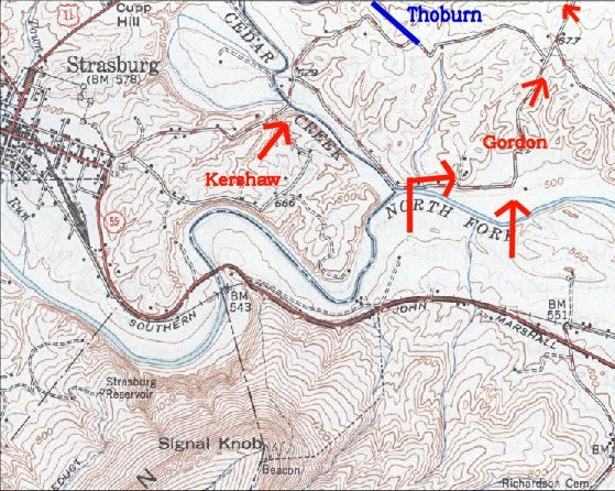
General Gordon and Stonewall's famed mapmaker Jed Hotchkiss climbed to the signal station on Three Top, or Signal Knob, to determine the Federal position. A frontal assault against the fortified Union front would be foolish, but they saw that a narrow trail alongside Three Top led to unprotected fords and the vulnerable Union left flank. Early approved Gordon's attack plan and placed him in command of the flanking column of Ramsuer's, Pegram's, and Gordon's divisions. At dark October 18, 1864, the Gordon's men began their approach march. Sheridan had been ordered to Washington for discussions, and VI Corps commander Horatio Wright was in command, but the Union army would likely have been surprised regardless.
|
 |
|
 |
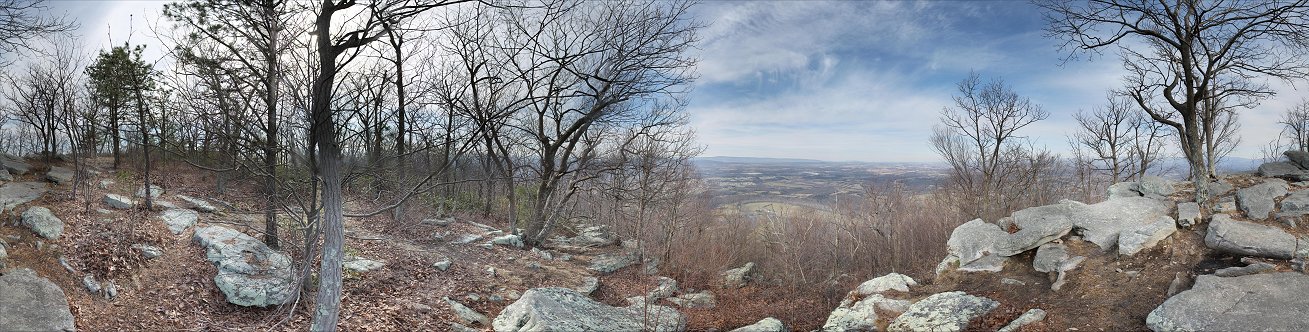
Thoburn's Position
Meanwhile, Kershaw's division crossed Cedar Creek undetected in the thick morning fog here at Bowman's Mill Ford. The division deployed in line of battle, but at 5 A.M. they were detected by the 5th NY Heavies, who were on the picket line part-way down the hill. The Confederates now moved forward, capturing all but about 30 of the 309 pickets. They continued up the hill, through a line of abatis, and over the entrenchments. An artillery battery near the center of Thoburn's division was taken, and the Rebels quickly entered the Union camp. The Federals were only now waking up, and many were not yet dressed. Panic rapidly ensued, and the Union division fled. The two brigades of Thoburn's division, part of Crook's VIII Corps, sustained 584 losses during the battle.

Map - Does not include interstates and cavalry
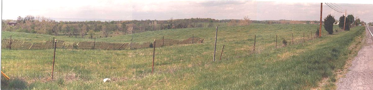
8th Corps Attacked
Emory's XIX Corps was holding a fortified line in the center of the Union position - facing Cedar Creek, off the picture to the left. This photograph was taken from just beyond the left flank of Emory's line at the 128th NY Monument, which is on the other side of the Valley Pike somewhere behind the large evergreen on the left of the picture. Crook's VIII Corps, minus Thoburn's division, was camped on the hills around and beyond the modern I-81 bridge on the right of the picture.
Crook was the next victim of the Confederate onslaught. Gordon's three divisions had deployed into line and advanced into Crook's camp shortly after Kershaw started his attack on Thoburn. Although some Federals stood and fought, many fled in panic through this location to the Union center. Some men hid in the ravine shown here until the Confederates advanced on Emory's flank. Wilde's brigade of Thoburn's division rallied here and counterattacked unsuccessfully. Those who did fight bought enough time for Emory to move some of his troops to face the Confederates. McCauley's brigade on the far left of Emory's line refused its flank to face the advancing Rebels. Kershaw's division crossed the ravine and slammed into the salient, forcing the Yankees back in hand to hand combat. The 128th NY lost 105 of its 310 men. Elsewhere, Thomas' brigade took heavy losses briefly holding off Gordon's divisions. The 8th Vermont lost nearly 110 of its 175 men. With the Valley Pike secured, Wharton's Confederate division crossed Cedar Creek and advancing up the Valley Pike from off the picture to the left, joined the attack.
From the VIII Corps Camps
From near the I-81 bridge and the VIII Corps camps, you can see something of the terrain, with the Valley Pike on the far right and the end of Emory's line. The high ground beyond are the easily defended hills above Cedar Creek. The wooded hill in the center is higher ground on the south side of Cedar Creek.
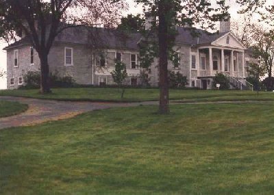
Belle Grove Plantation
|
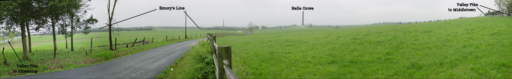
This picture is from Rt. 11, or the Valley Pike, toward Belle Grove Plantation. The Confederate divisions advanced to the Valley Pike, and over this field to Belle Grove. Belle Grove was the Union army's headquarters, and contained the army's staff and wagon trains. The tree line on the far left marks the fortified line of Emory's XIX Corps, which faced Cedar Creek off the picture to the left. The small hill slightly to the right of the tree-line is where Davis's brigade of the XIX Corps briefly resisted the attack. The 114th NY of this brigade lost 115 of its 250 men in the battle. Near Belle Grove plantation near the center of the picture, VIII and XIX Corps survivors held off the Confederates for about half an hour, long enough for the wagon trains to flee.
|
 |
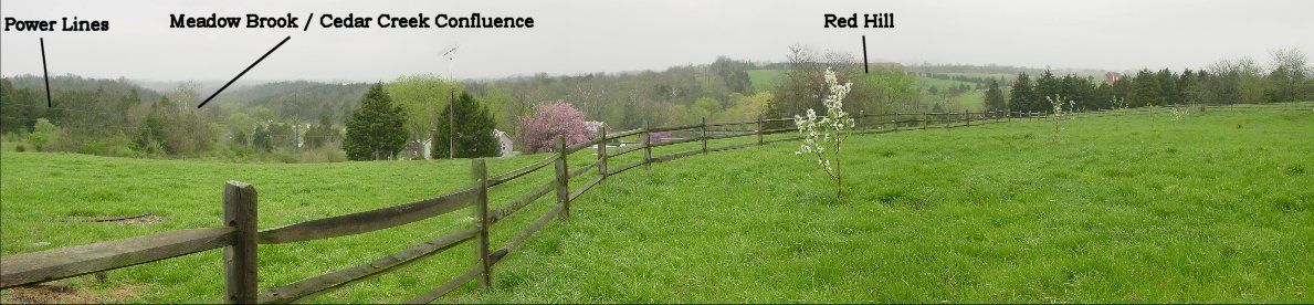
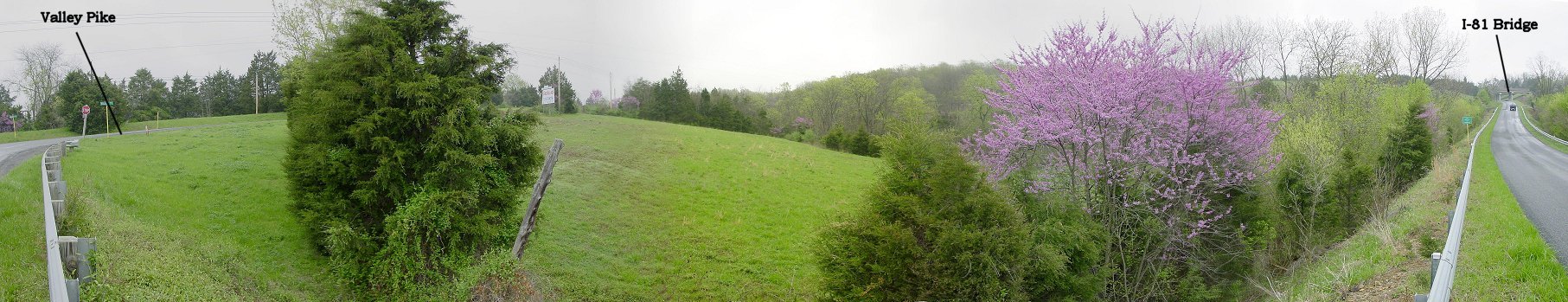
From Belle Grove to Red Hill
The power lines that you can vaguely make out on the left of the picture follow the road which passes Belle Grove and roughly follow the Confederate line of advance. The road dips into a hollow and intersects with Meadow Mills Road, which, along with Meadow Brook, parallels this hollow. Obscured by trees, Meadow Brook cuts through the hills Emory and the VI Corps were encamped on and flows into Cedar Creek.
Union resistance now centered on the ridge visible here beyond the Meadow Brook hollow, called Red Hill. The Union forces included VIII and XIX Corps survivors, but also the as yet un-engaged VI Corps of Ricketts which had camped on the hill. At about 7:30 A.M., this ridge was also evacuated, but this time the retreat was to the northeast, off the picture to the right, along the army's lines of communication.
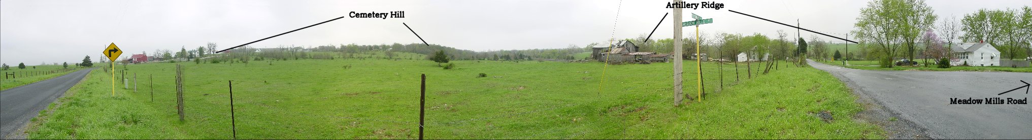
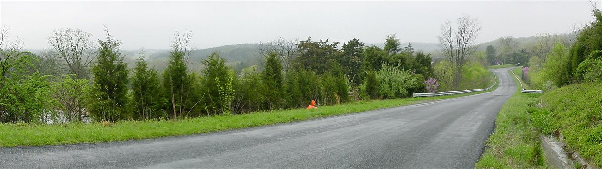
From Northern End of Meadow Mills Road
With the Yankees withdrawing northeast, the Confederates now switched the axis of their advance, following the Federals along the axis of Meadow Mills Road, visible on the far right of the picture. Gordon's and Kershaw's Divisions advanced along this road while Ramseur's and Pegram's Divisions advanced along the Valley Pike atop a ridge labeled "Artillery Ridge" in the photo. (We'll see later why I've it such.) Although most of the Union army was in retreat, the Confederates found Getty's division buying time on a hill labeled "Cemetery Hill" in the picture.
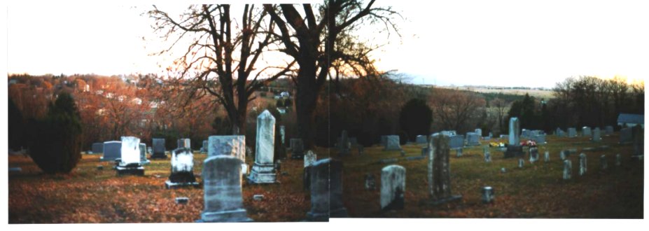
Cemetery
Getty's division of the VI Corps was the last Union unit to withdraw from the Red Hill area, and Getty saw the opportunity to delay the Confederates by making a stand on this hill to the west of Middletown, which we've already seen from the Confederate perspective. He took up position at 8 A.M. while the rest of the army was reforming to the rear. Getty's flanks were somewhat protected by cavalry, so Early hurled most of his army directly at him. The Middletown Cemetery has held by Bidwell's brigade. All attacks on the Union position were thrown back, and sometimes counterattacked. Early then positioned 20 cannon on the Valley Pike on the hill visible in the distance on the right of the picture. The bombardment did not dislodge the Federals. Only when a flank attack seemed eminent did Getty order a retreat. He had given the Union army two hours to reform.
Final Confederate Line
Early followed the retreating troops, but did not attack the new Union position. Instead, he took up position along a road extending into the distance from the house visible on the left of the picture. The Confederate line continued to the Valley Pike, where this picture was take, but further to the rear, off the picture to the left. A lull set in, and General Sheridan reached the battlefield. Finally, at 4 P.M., inspired by Sheridan, the Union army attacked. The fight included action in this small valley as Union forces pressured the thin rebel line. Early's forces broke and ran, and Union cavalry pursued relentlessly. The victory was decisive, and Gen. Ramseur was mortally wounded during the retreat.
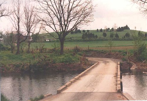
Bridge
Here, just south of Strasburg, a bridge over a small stream with steep banks created a choke point for the retreating Confederates. Retreating from left to right in this panorama, the retreating Confederates became chaotic after the bridge broke. The pursuing Yankee cavalry captured many Confederate wagons and artillery that were unable to cross the creek. The battle had begun well for the Confederates but ended as a disaster. There was no longer a major Confederate threat in the valley, and many of Sheridan's troops were now free for use around Petersburg. Fall turned into winter, which turned into spring. Sheridan once again advanced up the Valley, routing Early again at Waynesborough. He continued with his cavalry to Petersburg, where they were decisive in beating Lee at Five Forks.
topo map Kershaw's division crossed Cedar Creek at Route 635. Thoburn's men were on the hills to the northeast of there. McInturff's Ford across the Shenadoah was near a ravine along Route 611. Bowman's Ford was near where 611 makes a hard left turn. Gordon's column followed this road and deployed near the filtration plant and the Cooley Mansion just NNE of it. They struck the end of Emory's fortified line near the intersection of Route 11 and 840, and Wharton's division crossed Cedar Creek near where Rt. 11 now crosses. The Belle Grove plantation was along Route 727.
topo map After pushing past Belle Grove, the Confederates were held up on Red Hill north of Meadow Mills. Getty made his stand at Mount Caramel Cemetery. The final Confederate line was along Route 634, and its picture was taken from Rt. 11.
Back to Civil War Virtual Battlefield Tours