Chatham Dockyard - Early 19th Century to Victorian
As early as the 1660s, St. Mary's Creek, a body of water cutting through the bend in the Medway just north of the dockyard, had been considered for conversion into a basin capable of holding over twenty ships. The expense, however, was thought too great.
By the early 1800s, the Medway was silting up, threatening the very existence of the dockyard. Marc Brunel, who is better known for his later sawmill, had earlier developed a dredger which was used in the river, saving the yard. With the Industrial Revolution under way, there was the potential for massive change at the Chatham dockyard. With the yard essentially positioned along the center section of the "S" course of the river, Inspector General of Naval Works Samuel Bentham suggested that the river be straightening. A few years later in 1814, famed engineer John Rennie was given the job of reporting on the dockyard's problems and coming up with solutions. Rennie did, in fact, determine that a new river channel should be cut through the flat land across from the dockyard, and that the river's old course be made into a basin able to hold 50 large ships. Because of the projected cost of 685,000 pounds, this part of Rennie's plan was not adopted. Neither was a plan to instead create a basin on the land within the bend of the river opposite the Georgian yard. Some other suggestions were implemented, however, regarding new dry-docks.
Among them, however, plans to convert slips into dry-docks were not implemented. But since Rennie was asked to study making fifth dry dock, and since ships were becoming larger, land would be reclaimed from the river. Since docks would have to be deeper, a pump house was needed. More change, including labor problems, came with construction of HMS Achilles, a sister ship to the iron HMS Warrior. From then on, change in shipbuilding was rapid and radical. The Chatham dockyard would have to adapt or perish.
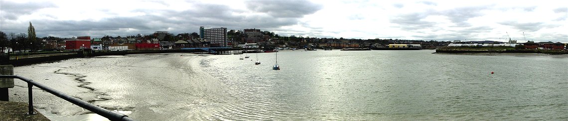
Southern Portion of the S- Turn in Medway
South of the dockyard, this is where the Medway curves back to the west. The flat ground across the river had been considered for a new channel for the river. You can see in this photo the great effect tides have on the river, something that made the area ideal of ship maintenance early on.
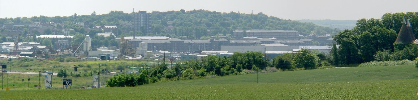
View From West Bank of the Medway
From higher ground to the west, you can see the Georgian dockyard, and the heights behind it, which were well fortified by the Napoleonic era. Vulnerable from attack up the river, and from invading armies inland, the dockyard required numerous defenses.
Also visible in the center and on the right is the flat area proposed for a new channel to straighten the S turn in Medway. A basin was another proposal for that area. Although these plans were never acted upon, another suggestion, to reclaim part of the river, was done where the left four covered slipways now stand. You can see that the rightmost covered slipway is at a different angle.
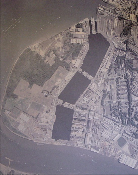
New Basins Fill St. Mary's Creek
This is an aerial photo on display in the Chatham Dockyard Historical Society Museum showing the more northerly bend in the Medway. Cutting through this bend, St. Mary's Creek had been considered for a basin as early as the 1600s. Rennie's grand plans, never adopted, also involved making a new channel through this bend near the creek. With the existing Georgian era dockyard visible in the area on the lower right of the picture (you can see the covered slipways and a mast pond), St. Mary's Creek was a logical area for expansion. In Victorian times, with work starting in 1862, the creek was made into the three basins you can see in the photo. Dry docks were constructed in the upper basin as well as additional buildings to handle the new steam navy. With the assistance of prison labor, these works were done by 1885.
Back to Chatham - The Royal Dockyard