Battle of the Clouds Map Page
Topographic Map
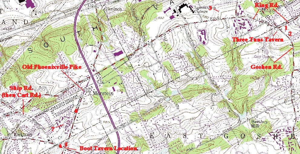
Unfortunately, suburbia has come to the battlefield, and as a result it is a frustrating site to visit. If you do intend to visit, don't plan on seeing much more than what I'm showing you here. The Hershey Road south of the college gives a decent idea of the size of the ridge at its highest. The location of the skirmishes in front of the American line are unknown - at least to me. The numbers on the map correspond to the numbers on the captions.
Important Note: Ed Wimble, of Clash of Arms, who has designed a wargame of the campaign e-mailed me the following interesting info on 6/16/04.
At Fort Mifflin there is a cannon (or two) that was recovered from a creek bed on the property of the old Church Farm School. This is the ground over which Washington's army retreated on their way to Yellow Springs that rainy afternoon. (As an aside: Today there is a little park created just a few years ago entitled "The Battle of the Clouds Park" near this same school just above Planebrook, or about 500 yards north and east from the old White Horse tavern. It has nothing other than its name to inform one about the battle and is just a few baseball fields/recreation area, but I believe it is roughly where Washington reformed his men after retreating down South Valley Hill... and possibly where he was informed of the approach of Matthew's Guards who had turned his flank, precipitating their further flight up and over North Valley Hill.)