Diorama
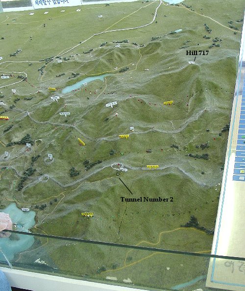
We were told Koreans don't like maps, but apparently they love dioramas. So do I. Here are several pictures of the diorama on display at the Iron Triangle Observatory. The lower center of the diorama is the area of the observatory, near were the railroad ends at the DMZ.
This is of the area east of Chorwon, between there and Kumhwa with north to the top of the picture. The two lines made of screen are the northern and southern borders of the DMZ. Tunnel number two is located near the outpost in the lower center shown by circular screen, and I assume the road leading to on the diorama is the road we took. Once again, I believe the coordinates on the Kumhwa map are vertical 52 horizontal 41. OP Harry and communist held Star were in the area of the screened off circles to the left. I believe the white line on the left is the rail line. The large hill in the upper right due east from the S curve in the railroad may be Hill 717 or Sobang-San. Not on the diorama but two and a half miles east southeast is Outpost Crush Communism overlooking the Kumhwa Valley.
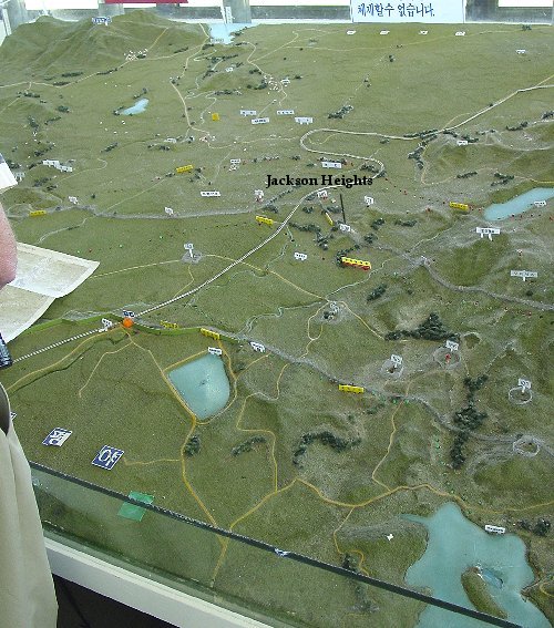
This is just west of the previous picture with north once again being the top. I believe the orange dot on the flat area in the lower left is the Iron Tiangle Observatory. The flat area near the top is the flat land in the Iron Triangle, which is dominated by the surrounding hills. This maded the hillmass between Chorwon and Kumhwa very valuable. The white line extending from the SW to NE corner is the rail line. Jackson Heights is the hill just south of the S curve in the railroad. OP Tom was located on a small hill south of Jackson Heights. The NE/SW ridge to the southeast of Jackson Heights was the location of OP Dick and communist held Old Charlie.