Fort Mc Henry
Built on a peninsula, Fort McHenry was designed to block a naval advance on Baltimore, Maryland. Named after a Secretary of War during George Washington's administration, five sided Fort McHenry replaced an earthen Revolutionary War fort. After just a few decades, in 1812 war with Britain broke out in response to British offenses on the seas, specifically the stopping American ships and the impressment of their sailors. In 1814, after Napoleon had been defeated, the British shifted their focus to the United States. In addition to waging war from Canada, the British decided to conduct amphibious attacks on the American coast. In August 1814, an amphibious force from the Chesapeake Bay burned Washington DC in retaliation for the American burning of York, Canada.
That September, they shifted their attention to Baltimore. Fort McHenry, along with sunken ships stretching across the harbor entrance backed by gunboats, blocked a British advance. Early on September 13th, specialized bomb ketches, ships equipped with shore bombardment mortars, began bombarding the fort with 1,500 bombs. Congreve rockets were also used. The range was too great for the American cannon to effectively respond. The garrison held during the 25 hour ordeal and lost only 4 killed and 24 wounded. With the repulse of a land advance from North Point, Baltimore was saved from capture and probable destruction.
On a British warship was a lawyer named Francis Scott Key trying to negotiate the release of a civilian. Key witnessed the bombardment and wrote a poem about the it, "The Star Spangled Banner", which became the national anthem in the early 1900s.
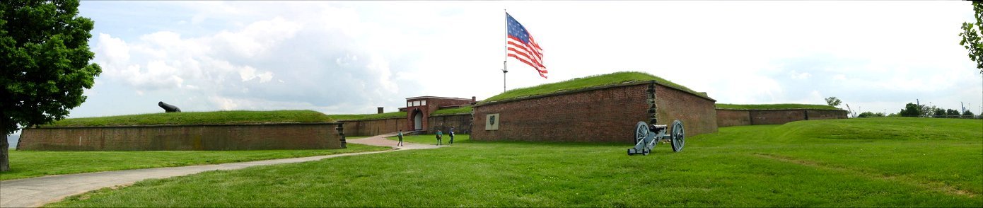
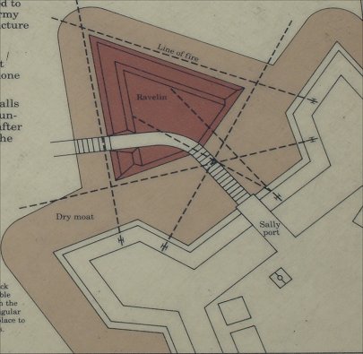
A typical five sided fort of the era, McHenry has diamond shaped bastions at each corner to provide fire along the curtain walls and the faces of the neighboring bastions. The prominent ravelin on the left of the picture was designed to help protect the entrance. See below.
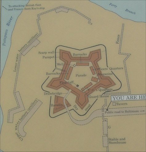
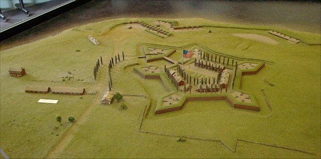
Park Service Maps and Diorama of the Fort Circa 1814
The fort's land entrance was different in 1814. A dry moat, or ditch, surrounded the fort. To enter the fort, you first crossed a bridge to enter the ravelin. Passing through it, you would then cross a drawbridge to the sallyport.
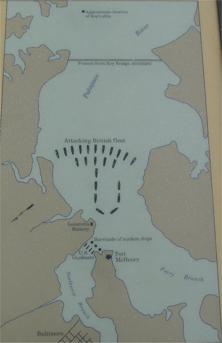
Park Service Map of the British Bombardment
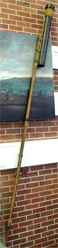
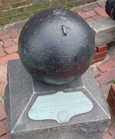
Reproduction Congreve Rocket and a Mortar Bomb Fired at the Fort
As we all know, the rockets' red glare and the bombs bursting in air gave proof through the night that the flag was still there.
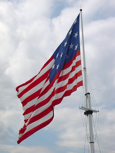
When conditions are right, the park service flies a full scale nylon replica of the flag flown during the bombardment.
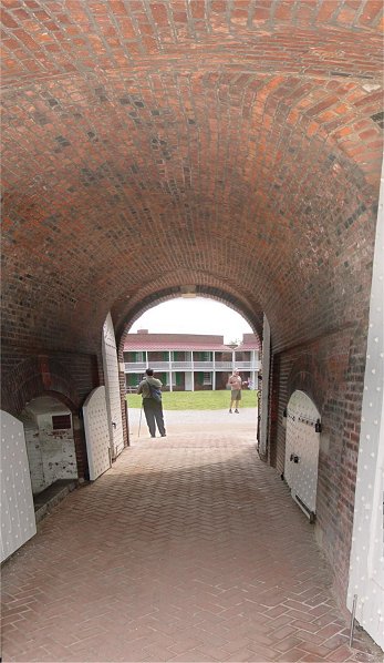
The sallyport was altered after the war.
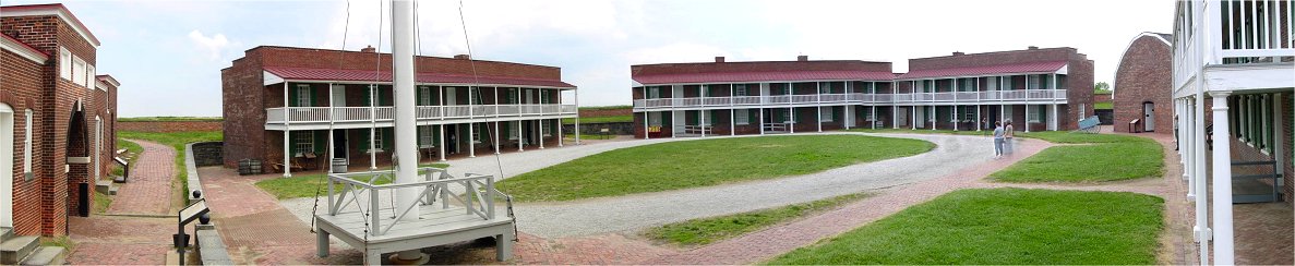
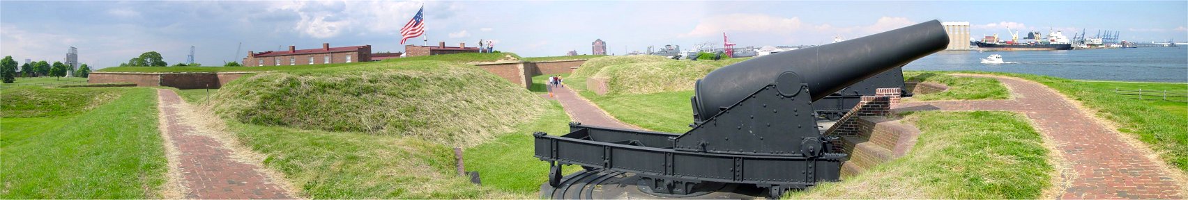
Parade
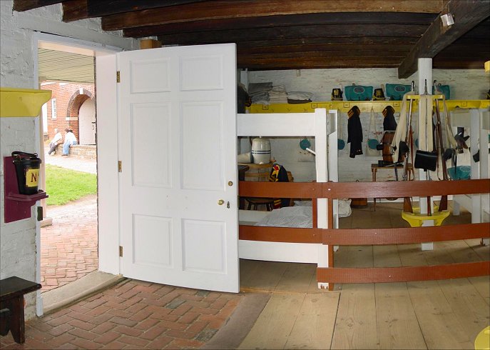
This is the view inside the fort. The sallyport is on the left with the flagpole nearby. Buildings surround the parade ground. On the far right is the Commanding Officer's Quarter. The barn-like structure is a magazine constructed after the war, and Officers' Quarters are visible behind the two ladies. The other two buildings are barracks, and you can see inside of one in the picture below.
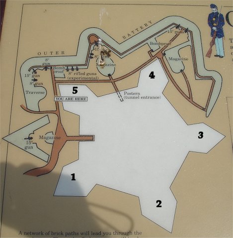
Park Service Map of Outer Defenses
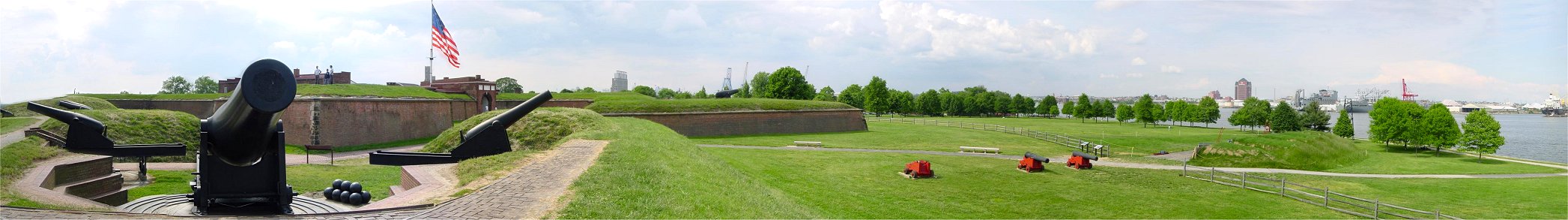
Outer defenses were begun in the 1840s to supplement the defenses. The bird poop encrusted NPS map above should help you better understand the panoramas below. Added to it are the numbers of the bastions.
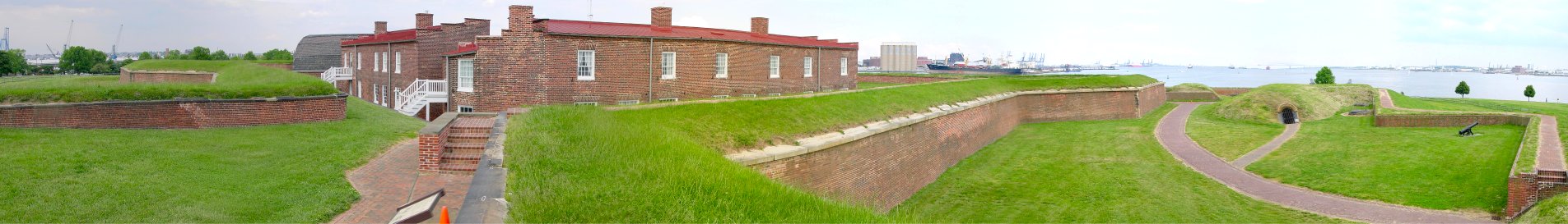
From Bastion 3
Bastion 3 got a direct hit during the 1814 bombardment. The right flank of the outer defenses can be seen on the right of the picture.

From Bastion 5
This nearly 360 degree pan shows much of the outer defenses. The left flank of the defenses is on the right of the picture.

From Bastion 4
From the Outer Defenses
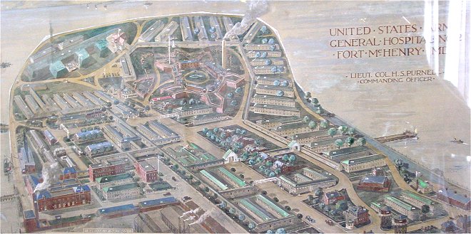
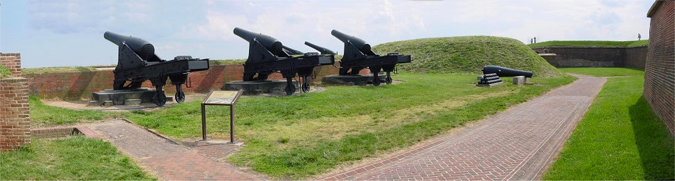
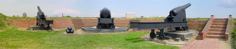
You could never tell it now, but Fort McHenry later grew to become a much larger facility with numerous buildings.
Back to John's Military History Page