Hunter's Raid Part 2
From Blue Ridge Parkway
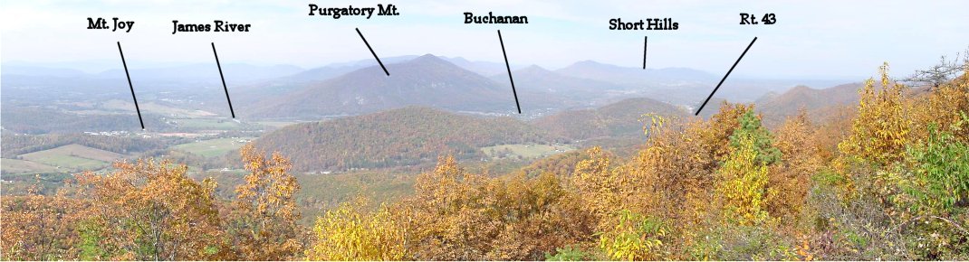
From the Modern Blue Ridge Parkway, you can see Hunter's route to avoid the treacherous and defended direct route to the Peaks of Otter, modern Rt 43. Continuing up the Valley Pike parallel to the James River, Hunter turned left at Mount Joy up the road to Boblett's Gap, which crests the Blue Ridge two miles southwest of modern Rt. 43.
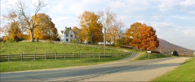
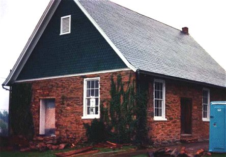
Mt. Joy
Col. Anderson, a brother of the General Anderson who headed Tredegar in Richmond, owned the house called Mount Joy where Hunter's army turned off the Valley Pike. Hunter ordered it burned but the officer charged with the task only burned the outbuildings. When he reached the top of the mountain, Hunter asked the officer if he had burned the house, and he admitted that he hadn't. Hunter ordered him back down the mountain to burn the place. The current house was built on the foundations of the wartime home. This is just one small example of Hunter's addiction to arson.
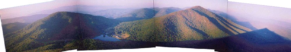
Peaks of Otter - View From Sharp Top
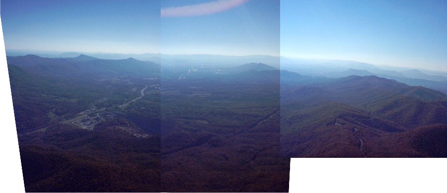
This is the spectacular view from the top of Sharp Top at the Peaks of Otter. To the right is Flat Top, and to the left is Harkening Hill. Buchanan is obscured behind the mountain to the left of Harkening Hill. McCausland and his men retreated 1500 feet up this mountain along a narrow road (now Rt. 43) which skirts the mountainside. The Confederates felled trees and skirmished with the Federals to delay them as long as possible. Not all pack animals and wagons made it up this treacherous climb.
The advancing Federals moved along what is now the Blue Ridge Parkway and past the famous lodge visible near the modern day lake. Some of the men hiked up Sharp Top to take in the view and destroyed the roof of a stone house at the top. Meanwhile, other Federals stole the lodge's food. One officer jokingly signed the guestbook, and next to his name was written, "He didn't pay his bill." Hunter's men then descended the mountain and passed through Liberty, now Bedford, on the way to Lynchburg.
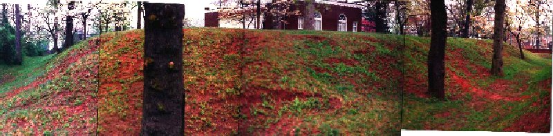
Fort Early
McCausland and his men delayed Hunter over the Peaks of Otter and along the route to Lynchburg. Meanwhile, D.H. Hill and Harry Hays in Lynchburg were preparing a fortified line to protect the city. The earthwork shown above already existed and was renamed Fort Early. It became the basis of the new line.
Quaker Church
Breckinridge and his men had moved from Rockfish Gap and were now entering Lynchburg on June 17th. Early's men would soon join the defense.
Hunter's men, however, were rapidly approaching the city. To buy time for his men to reach the city, Early sent Imboden out of the defensive lines with 1,000 men and 5 guns. Imboden's men made crude entrenchments near the Quaker Church, then in ruins. Hunter ordered Averell, then Crook to attack this position, and after flanking the line, the Yankees pushed Imboden back. Union troops pursued them to the main defensive line which was too strong for them to take. It was too late in the day to assault the city, and Confederate troops filed into the defensive line that night. At full strength, the Confederates mustered 15,000 to 16,000 men behind entrenchments to oppose Hunter's 19,000 to 25,000 men. After testing Confederate defenses on the 18th, Hunter decided that he could not take the city, so he began the long retreat to West Virginia.
Aerial View Looking West From Over the Blue Ridge
In this admittedly borderline gratuitous aerial panorama, you can see the western end of Buford's Gap on the far left, an ideal place for Hunter to delay his pursuers. Any delaying action here could only be temporary since both sides had sent cavalry across the mountains to the left, where they passed through the Stewartsville area, and also across the Blue Ridge on the right - once more by way of the Peaks of Otter. All of these columns met in the Roanoke Valley, the relatively flat area visible in the center distance of this photo. Early's men skirmished inconclusively with Hunter at Salem, probably in the area where the Salem Turnpike intersects modern Rt. 419. In Salem, Hunter switched direction to the north, hoping to escape through the mountains to the safety of West Virginia.

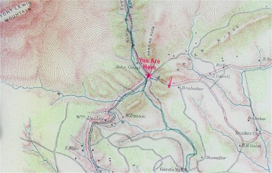
McCausland Attacks at Hanging Rock - View From Near "Brubaker" on Map
Hunter's column was slowed as it passed through a gap in the mountains at Hanging Rock. McCausland's cavalry, which had crossed the Blue Ridge at the Peaks, paralleled Early's advance. The Confederate cavalrymen, having approached Hanging Rock along the modern road on the right entering the four-laned road prominent here, unlimbered some artillery on a nearby hill and moved on the Union column. The Confederates wreaked havoc on the Union trains, but newly arriving Union troops pushed them back and reopened the line of retreat. McCausland's cavalrymen sniped at the Federals, and his artillery bombarded the Union wagon trains as they retreated down this road. The Confederate fire did more harm to the pack animals than to the troops, and Hunter continued his retreat without further harassment.

| From Near Hanging Rock CW Trails Sign Hunter's Army approached this area through the gap marked in the panorama followed by Imboden's Confederate cavalry. Hunter's column crossed Mason's Creek and continued north along modern Dutch Oven Road, marked on the panorama as "Hunter's Retreat Route". As the artillery was passing, McCausland struck. Repulsed, McCausland had just missed cutting off Hunter's retreat. Had more Confederate cavalry been available, and had Early's infantry also arrived, Hunter's Yankees could perhaps have been destroyed. |
 |
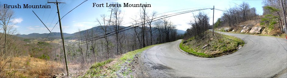
From Catawba Mountain Looking South
Having passed through the narrow gap between Brush Mountain and Fort Lewis Mountain, Hunter's men were soon faced with Catawba Mountain, which rises 700 feet over the valley below.
The difficult climb of Catawba Mountain was just a taste of what was to come. About six hundred horses died ascending the next great obstacle, Potts Mountain, an 1,800 foot climb. Having started the expedition with few rations, and with a drought in the Virginia that year, Hunter's men were ill prepared for the march through the sparsely populated mountain region and were starving by the time they reached safety.
The threat to Lynchburg, and therefore to Richmond, was passed. With Hunter in West Virginia, the Valley was clear of Federals. Early advanced swiftly down the Valley and threatened Washington D.C. He was now Lee's last hope of success as the major armies settled into siege around Petersburg. To follow Early's Confederates on their journey to Washington, please see the Monocacy section.
Back to Civil War Virtual Battlefield Tours