Plymouth
Harbor, Defenses, Dockyard, and Victualling Yard
So named because it is at the mouth of the Plym, Plymouth in southwest England is an important site of British naval and maritime history. The Roanoke Island colonists left England for America from Plymouth, as did the Pilgrims for Massachusetts several decades later. Drake sailed from Plymouth to fight the Armada in 1588 after a game of bowls. After the Civil War, the Citadel was built by Charles II in 1670-71 in part to control the town, which had supported Parliament during the late unpleasantness.
Since wind blows generally from the west, Plymouth was a natural base on western Channel for the interception of invasion fleets. With the Glorious Revolution of 1688, France undeniably became Britain's greatest threat, and starting in 1690s, a major dockyard was constructed near Plymouth along with an ordnance yard in order to deal with the threat. Plymouth was Britain's best base from which to blockade the French navy in Brest, France's primary Atlantic base. The blockade of Brest, more than any other single factor, protected Britain from a French invasion. Currents were difficult, and Plymouth was never a safe refuge when storms approached from the south. With construction begun in 1812, a jetty designed by Rennie helped make Plymouth a safer anchorage. Later, a victualling yard was added, and a large dockyard expansion was begun in 1844 to accommodate the needs of the steam navy. Sadly, the old dockyard was bombed by Nazis, and what little remains of it is generally inaccessible to tourists, as is the Citadel. Nevertheless, the area is beautiful, interesting, and well worth a visit.
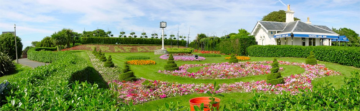
Combination of two of Britain's passions, gardening and naval heritage. Note "Trafalgar" spelled out on the hillside and the bush shaped like a ship of the line.
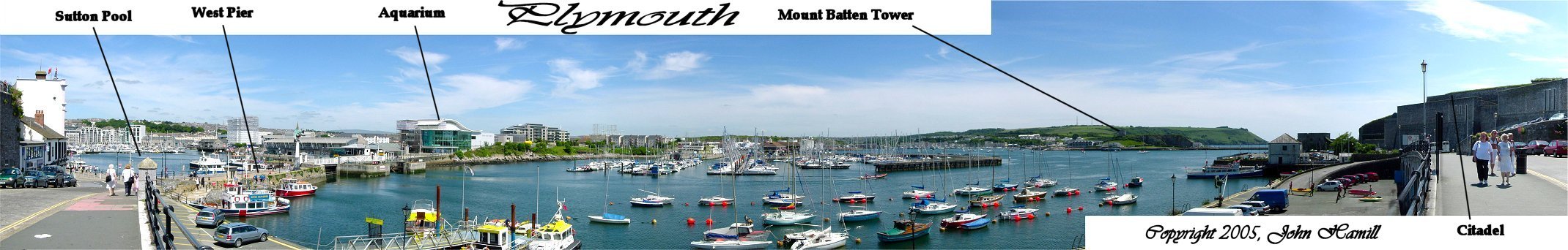
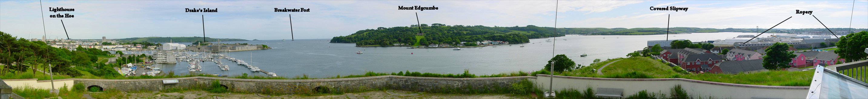
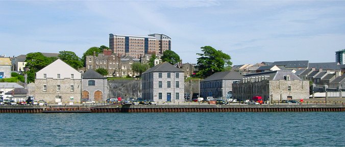
Originally, the town of Plymouth formed around Sutton Pool, or harbor. An east and west pier sheltered the area, the Mayflower colonists left from the west pier. Queen Anne's Battery was built on a tip of ground beyond the piers hidden behind the modern marina. The Cattewater, essentially the mouth of the Plym, separates this area from Mount Batten. A tower on Mount Batten was built at the same time as the Citadel to protect the town by controlling the narrow stretch of water here. The area below the Citadel on the right was the location of the victualling office which existed before the Royal William Victualling Yard was built in the 1800s.
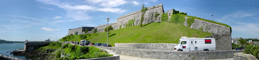
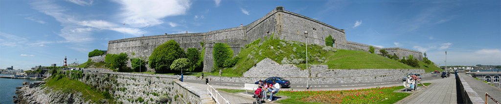


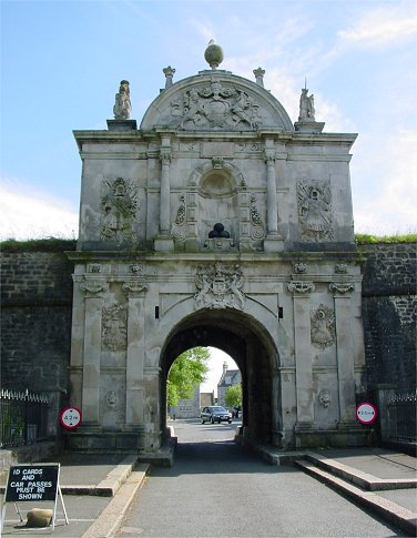
The Citadel
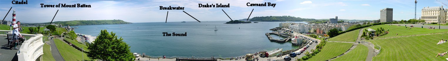
The Hoe
It is said that when the Spanish Armada was first sighted, Drake was playing bowls on the Hoe and that he finished the game before setting sail. In addition to the Citadel and the tower on Mount Batten, fortifications on Drake's Island helped defend the area. The island was first fortified in the 1580s. In Victorian times, a small round fort was added at the breakwater. On the right of the pan you can see the Tamar bending around toward the Sound. The Royal William Victualling Yard and Devonport Dockyard are in this area. Let's walk in that direction.
From Mount Wise
If you have good eyes, you can make out the lighthouse at the Hoe, which we just walked from. From this angle, you can see the Breakwater Fort, and Drake's Island and the Sound are still visible. Directly below Drake's Island is the Royal William Victualling Yard.
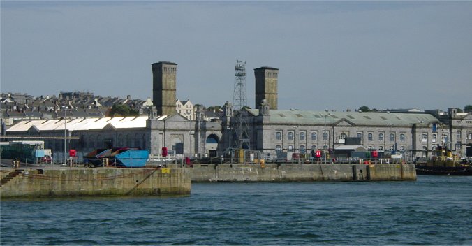
By 1824, the Cremill peninsula, where the River Tamar enters Plymouth Sound, was purchased by the government. Construction of the Royal William Victualling Yard began after Parliament allocated money the next year, and the facility was finished in 1832. The yard included a tidal basin for loading and unloading, a slaughterhouse, a bakery, a brewery, and more to prepare food.
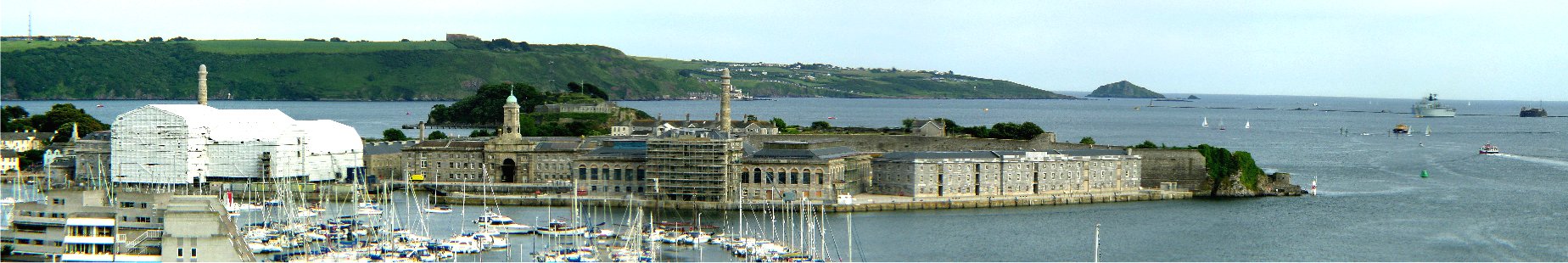
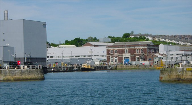
On the far right of the pan, where the Tamar bends east, you can see the old section of the Plymouth Dockyard, specifically a covered slipway and the remaining buildings of the ropery. The long Spinning House survived World War II, but the Laying House next to it did not. The two smaller parallel buildings where the dockyard wall projects out are the Hemp House and Black Yarn House. A basin was between the ropery and river, which was lined with slipways and dry docks. Mount Wise, where this pan was taken, was fortified to protect the dockyard's land and sea approaches. Defenses were also built in the vicinity of Mount Edgcumbe on the opposite side of the river. A gunwharf was built below Mount Wise in a cramped and inconvenient place that isn't quite visible in this view.
This is a zoomed-in view of the Victualling Yard, which is seen here being preserved, and I believe being converted into a shopping mall.
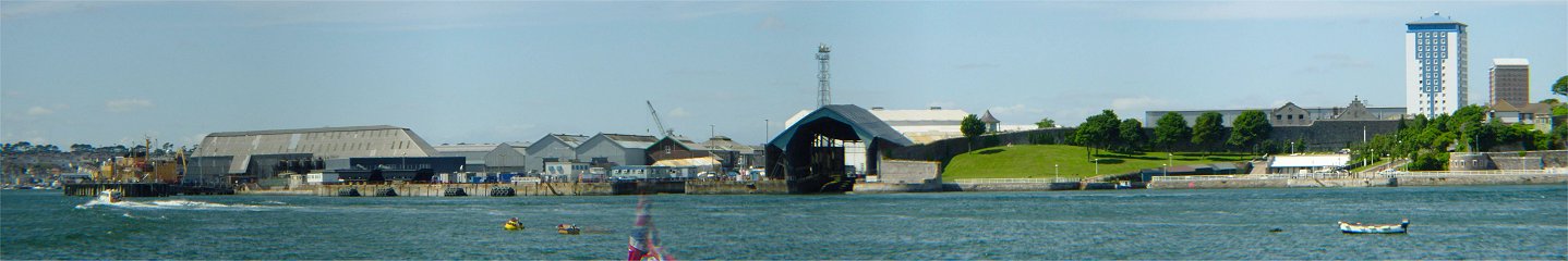
Southern Tip of the Old Dockyard
On the right of the pan is an ugly blue building of the kind you might expect in the old Soviet Union. Below it to the right I believe are the remains of some fortifications. The stone buildings to the left of the ugly blue building are the ends of the ropery buildings, the Laying House and the Hemp House. Following the stone dockyard wall, you come upon a covered slipway and a dry dock. The covered slipway or dry dock on the left faces another direction because of the bend in the river.
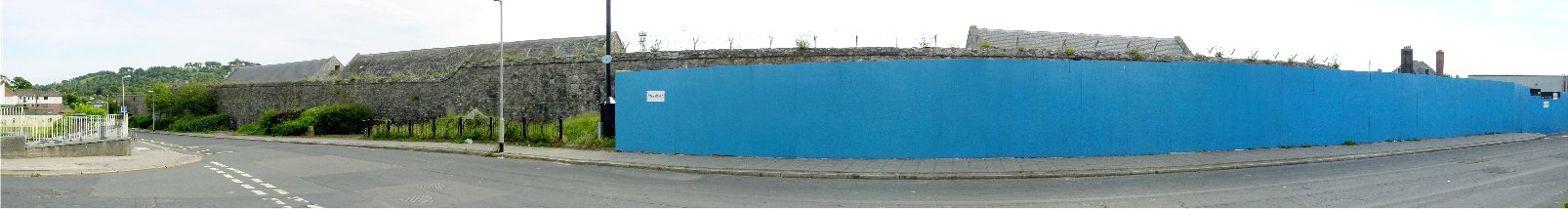
Rope Buildings from Outside the Walls
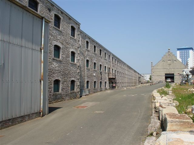
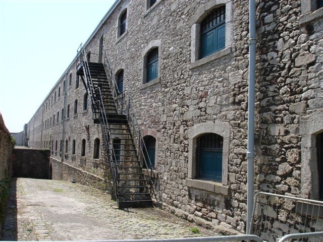
The old dockyard is still a naval base, and wire now tops the stone wall. Four buildings directly behind the wall, from left to right, were the Hemp Houses, the Black Yarn House, the Tarring House, and the White Yarn Houses. Hemp was stored in the hemp houses upon arrival and later processed in a hatchelling house before being spun into rope in the long buildings behind these. (not visible here) New rope was stored in the White Yarn House before being coated with hot tar in the Tarring House. It was then dried in the Black Yarn House before use.
 |
 |
 |
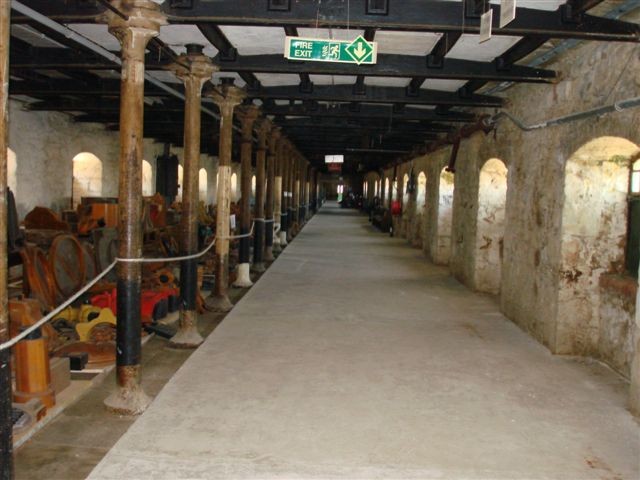 |
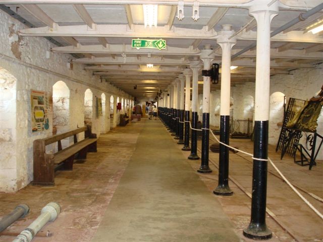
Rope Buildings from Inside the Dockyard Walls - Photos courtesy of Bill Kennington
Morice Ordnance Yard
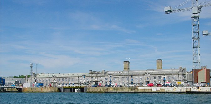
Since the gunwharf below Mount Wise proved to be a bad site, in 1719, land north of the dockyard was purchased for construction of an ordnance yard. It was used primarily for the storage, maintenance, and distribution of weapons, mostly for the navy. A wharf was constructed followed by two three-story buildings, which can be seen on either side of the above photos. These storehouses held things like guns and carriages and featured wooden truckways to ease the movement of items within the buildings. A magazine, since removed, was between the two buildings, with two cranes on either side. You can see stairs climbing the rock cliff, which was created when the hill was cut back to make more space for storing guns and ammunition. The Officers' Terrace, prominent atop the 40 foot high cliffs, were completed in 1723, and the yard as a whole was finished in 1724. Fortunately, Nazi bombs largely spared the Morice Yard.
Victorian Expansion
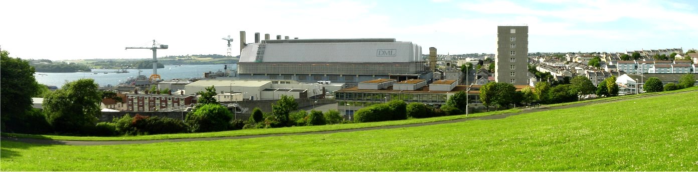
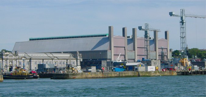
Mud flats were to the north of the Morice Yard, but in the Victorian expansion, these were made into a massive new addition to the dockyard. The new steam and steel navy required much larger and more advanced facilities for the larger ships with new technology, larger basins, larger dry docks, and more buildings. Although separated by a hill from the old yard, a 3/4 mile long tunnel was dug to connect the old and new yards to ease the movement of materials. The new yard featured a large quadrangle building with a glass roof and two towers. Modern day covered frigate repair shops are also in the Victorian section.
Except material so noted, all material copyright 2005-06 by John Hamill