Portsmouth Defenses
Zoomed View From Ft. Nelson
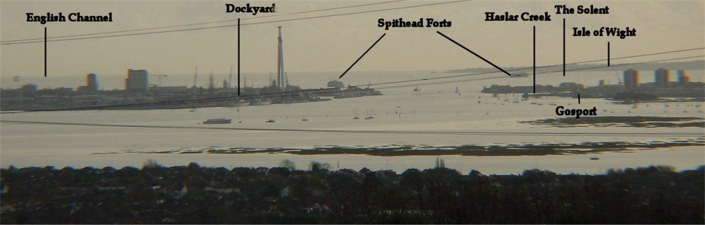
The Royal Dockyards in Portsmouth were vital to British naval power, and great expense was incurred to protect them. This view from the high ground north of Portsmouth gives a good idea of the geography of the area. Both Portsmouth and Gosport are on small projections into the English Channel (technically Portsmouth is on an island), and Portsmouth Harbor lies between the two. Just to the west is the Isle of Wight, the large diamond shaped island clearly visible on maps of Britain. Often military forces were sent to the island prior to being sent overseas in order to prevent the massive desertions which would result when the destination was an unhealthy tropical one. The body of water between the mainland and the Isle of Wight is called the Solent, and the area near where the Solent merges into the Channel is called Spithead. Strong currents in the Channel and the Solent were exploited by the English during the French invasion attempt of 1545 (best known for the sinking of the Mary Rose) and later in 1588 against the Spanish Armada.

Portsmouth was originally protected by crude lines of earth and timber in the 1300s. The Round and the Square Towers were built in the 1400s and were improved in Tudor times. The Square Tower was used as a gunpowder storage, but because of the danger to town, this was moved to Priddy's Hard in the 1770s. Both Portsmouth and Portsea were encircled by fortified lines in the 1600s.
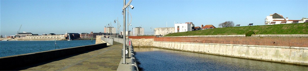
Entrance to the Harbor
Visible on the left across the water is the Blockhouse in Gosport, begun in the 1400s and similar to the Round Tower to which it could be linked by a chain in order to bar entry into the harbor. Gosport was encircled by fortified lines in the late 1600s. On the right half of the picture is a bastioned fort which appears to date roughly from the 1700s.
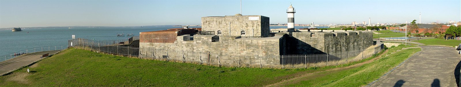
South Sea Castle
Henry VIII first attempted modern defenses against gunpowder weapons in the early 1500s. The South Sea Castle shown here was built in 1544 and expanded during the Napoleonic Wars. Henry VIII witnessed the sinking of the Mary Rose here. The fort was built outside of the town of Portsmouth to the east of the previously shown forts. At the time of its construction, the trace italienne in which all dead ground was eliminated through mutually supporting bastions was not yet completely accepted or understood by the English, and so this fort is not a typical design of the era. Some other contemporary English forts were even more unusual, one being essentially made of concentric overlapping rings.
In the mid 1800s a series of expensive forts were built further inland to protect both Portsmouth and Gosport. Fort Nelson was one of these structures. Diplomacy and technological developments soon made these forts obsolete, and they are known as Palmerston's Follies. In addition to the inland forts, several expensive iron armored forts were built in the Solent itself. One of them is visible in the left of the picture. Due to the difficulty of constructing a foundation on the sandy sea floor, one of the forts was not completed.