Route Nationale 46
What would be, by necessity, the main supply route for the American
army ran near the boundary
of the 28th and 35th Divisions - this was the Route Nationale No. 46
running
north from Neuvilly to Varennes. The Germans, of course, knew
this and blew a mine in the road and destroyed the bridge
over the Aire near Boureuilles. There was already a mine crater
in the road made by the French over a year before.
The repair of the bridge and road craters took a prolonged period
of time and caused a great deal of traffic congestion. On the
first day it was
almost impossible for artillery to advance to continue to support the
infantry.
It was for a time impossible to bring forward food and other
supplies and bring back the wounded. Although the road was within
the boundaries of the 28th Division, it was very near the 35th
Division and history has not assigned blame to any specific person or
organization for not having engineering units close to the front and
immediately available to begin repairs.
The best decription of the fiasco is in "Company A Twenty-Third
Engineers, A.E.F." by a veteran of the unit, Robert M Stack. On
page 70 he writes,
"We are all consious that death goes
hand in hand with war, but uncalled for death does not go hand in hand
with anything. When they speak of "Universal trainin" let us
ponder this for a moment. Is there such a thing as an Army
officer with judgment along construction lines? We don't mean
Ninety Day Wonders, we mean Army Officers, the men that call their way
of passing the time their profession... To not criticize in a
case like this is far worse than unpatriotic... If our orders had
been other than what they were, it wouldn't have taken place..."
French Prime Minister
Clemenceau tried to visit the front using the Route Nationale and became
ensnarled with all the traffic. Blaming the mess on
Pershing, he appealed to President Wilson to remove Pershing from command.
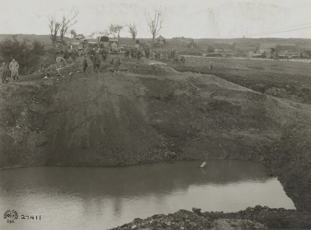
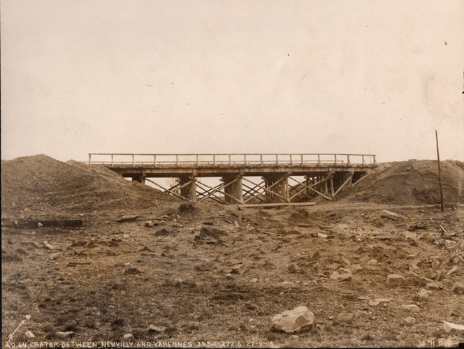
View of Crater from North Side
Robert Stack wrote,
"We walked for perhaps a kilometer or
two when a great yawning gap in the road confronted us. This
crater was located just to the rear of that which had been the
third-line trench twelve hours previous. The obstacle had been in
existence since 1916, as the French at that time had logical reasons
for believing that the enemy was going to drive in through this
direction, and they had taken this method of retarding them; by loading
a culvery which extended under a thirty or forty foot embankment on the
highway with high explosive, and had exploded the same. The
result was that it formed a great mine crater approximately forty feet
deep and ninety feet in diameter."
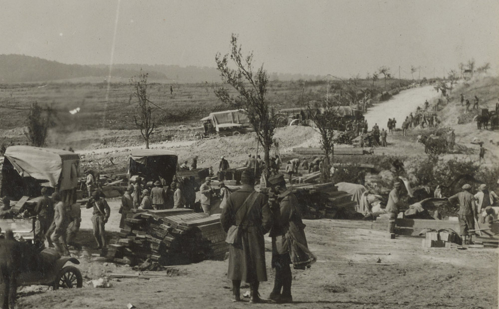
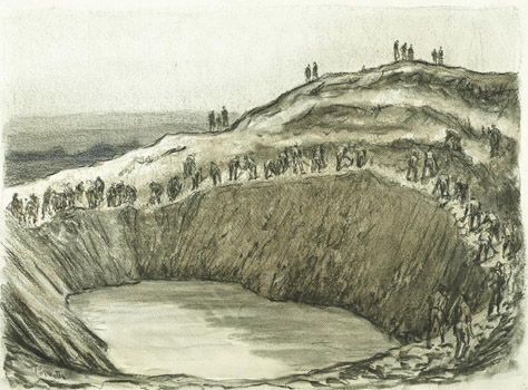
An official Army artist recorded this scene of artillery being taken
around a mine crater on the road to Varennes. Because a cemetery
is depicted, we know that this is the southern crater. At right
note that engineers are using shovels to fill the crater.
Robert Stack wrote,
"For the driving American Army it
became necessary to either bridge the gap or construct a "shoo-fly" (a
detour road). The highway on which this existed was the main line
of communication to this sector of the Argonne Front and to congest the
traffic would mean lives. More engineers were coming up, all with
picks and shovels, and excavation was started for a "shoo-fly"????
Approximately a thousand feet of 2-way traffic road was going to
be constructed over a marshy, soft draw including about 80-foot span
wooden bridge. This road was to be of a Telford base with a
wearing surface of six or eight inches. This would require a
thousand cubic metres of stone at least. There were fifteen
hundred men there, in perhaps a fifteen acre plot to build this job -
but there was no stone. Back at Neuvilly was that great storage
dump which we had been heaping up for days, and this was to be trucked
up to the shoo-fly. But ere the first Mack truck had made its
load of precious material, traffic was blocked for a mileback of the
crater, making it impossible for continuous train of trucks to
keep the men supplied."
"For twenty-four hours that crater tied up traffic, and then a single
line traffic was permitted through consisting of nothing but
ambulances. Forty-eight hours saw a double line traffic through,
and there lay the crater - a matter of spanning ninety feet with no
supply dump with a goodly supply of mud and water to contend with.
And engineering beams and plank not six kilometers away.
Had this obstacle ever been considered by Army Officials in those
two years? If so, why call them engineers"
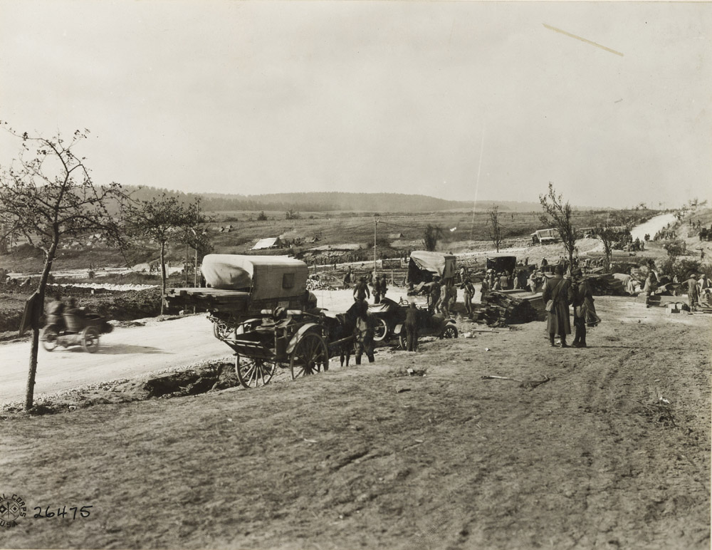
Photo taken Oct 5, 1918
Photo is looking west from a position just south of the crater. A temporary
cemetery is visible. At right you can see wood laid down as part
of the bridge over the crater.
Caption reads:
"On Neuvilly-Boureiulles Road. French and American troops making
repairs on a road mined and blown up by the retreating Germans."
Zoom views below:
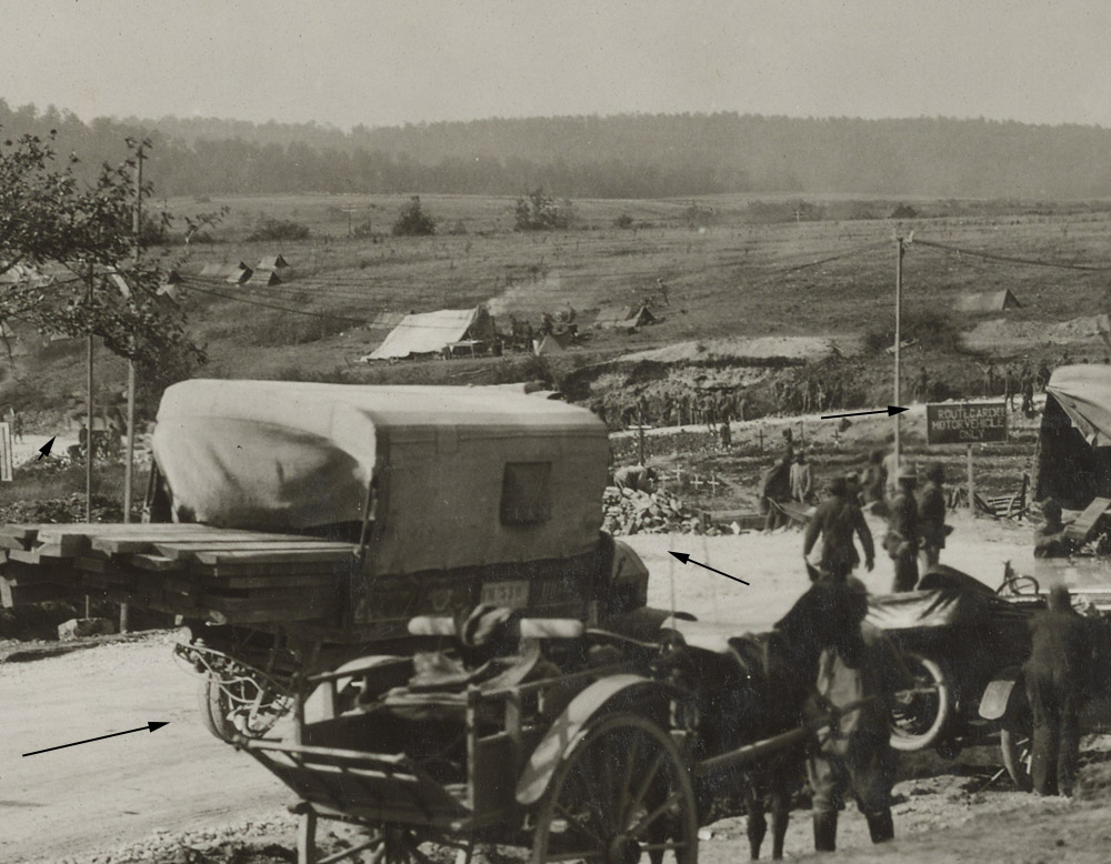
Arrows indicate detour route
Zoomed view of bridge construction
The photo shows rising ground beyond the road and the cratered crest of Butte Vauquois. You can also see a smaller
parallel road going into the wartime site of Boureuilles. The
post war village of Boureiulles was built along the Route Nationale at
this crater location and to the north and south of it.
In the photo note the detour gravel road and the temporary cemetery.
Date taken: Nov 5, 1918 Caption reads:
"Camera pointing to 65 degrees magnetic "Dead Man's Hill" which was one
of the hardest strong points to gain. It was necessary for the
Americans to cross the low ground under the fire directed from this
point. Neuvilly-Varennes Road."
Dead Man's Hill seemingly refers to Butte Vauquois.
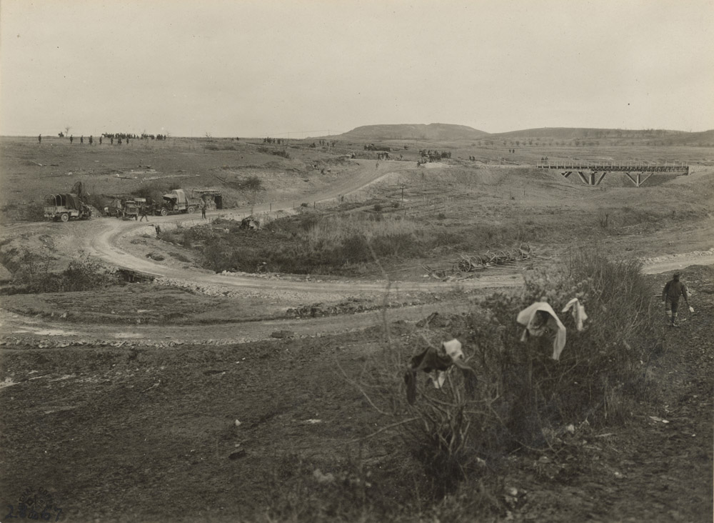
Photo taken Nov 5, 1918, caption reads:
"Road runs south to north in line of American advance. Picture
made looking magnetic east showing bridge where road was mined and
blown up by the Germans in their retreat. The Americans advanced
over the ground shown in the foreground and middle distance and took
the hills shown in the distance. Traffic was tied up at this
point until a switch road shown in the foreground of the picture could
be built and a bridge spanning the breach made by the mine constructed.
Reparation was made under artillery fire and bombing. The
hill in the distance, extreme left, known as "Dead Man's Hill" is mined
with a network of tunnels, had electric lighting and ventilation
system. Neuvilly-Varennes Road."
View looking west from where the detour road intersects with the main road.
Photo taken September 30, 1918 - four days after the offensive began
and the detour road is still in use, so the bridge over the crater has
presumably not been finished. Caption reads:
"Traffic going around great crater which had been mined by the Germans. Between Neuville and Boureuilles."
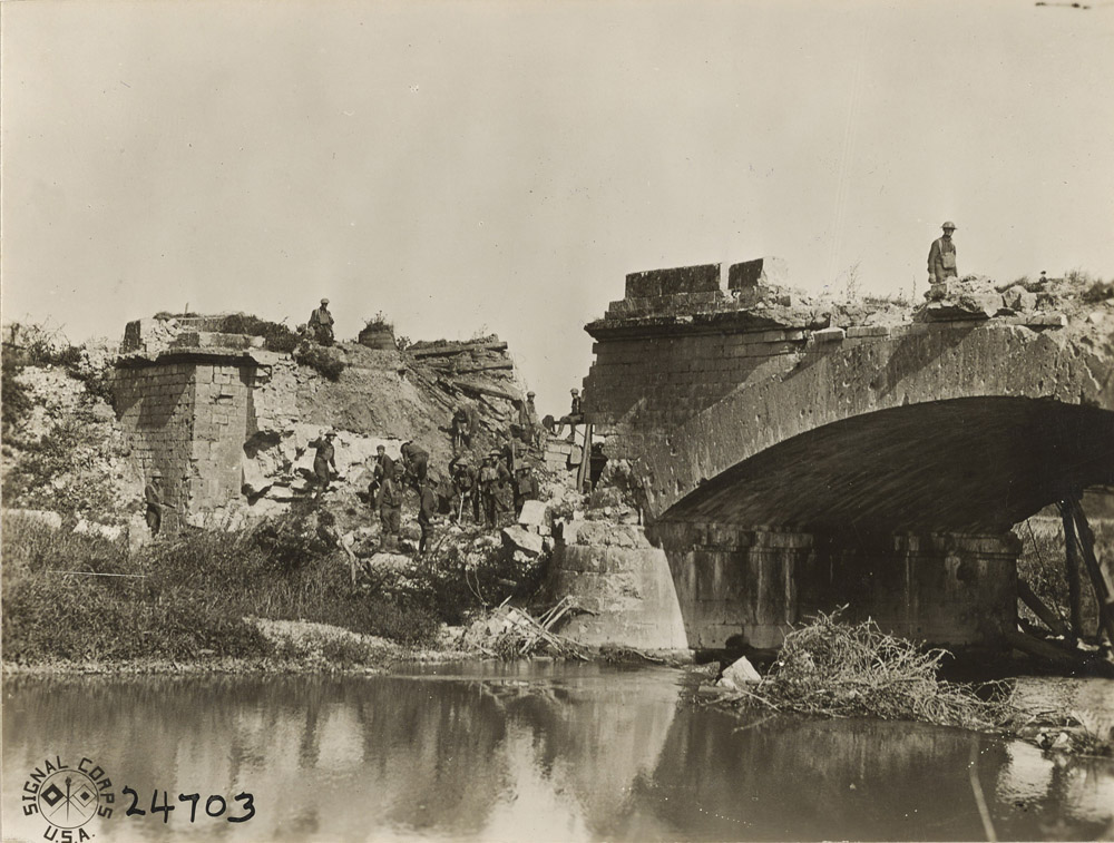
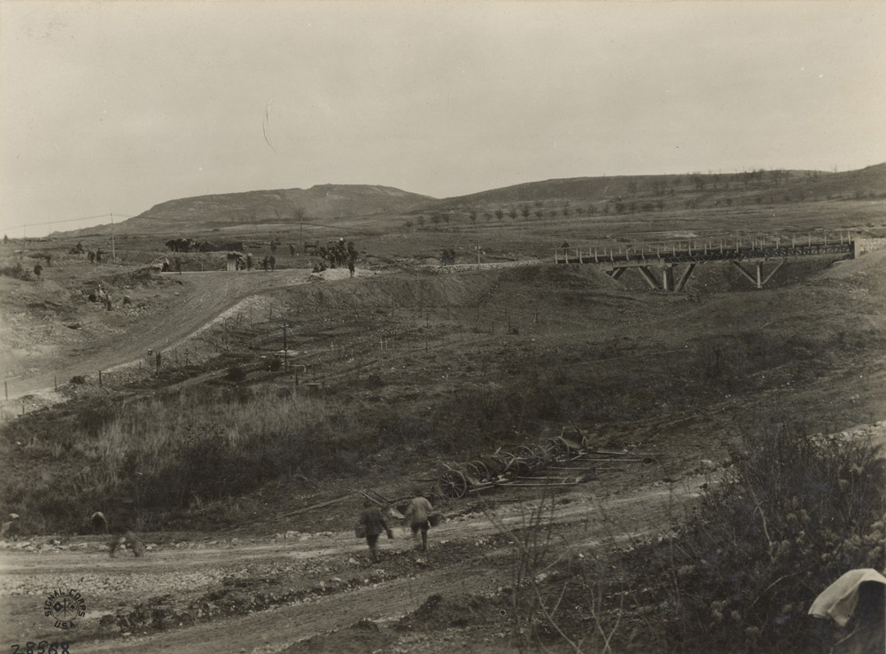
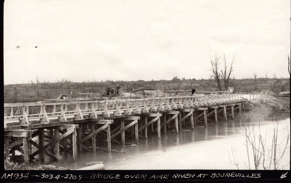
Bridge Over Aire River
Photo taken September 26, 1918, 12:15pm
Caption reads:
"Members of Co E and A, 103rd Engineers repairing a dynamited bridge."
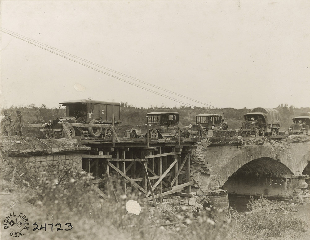
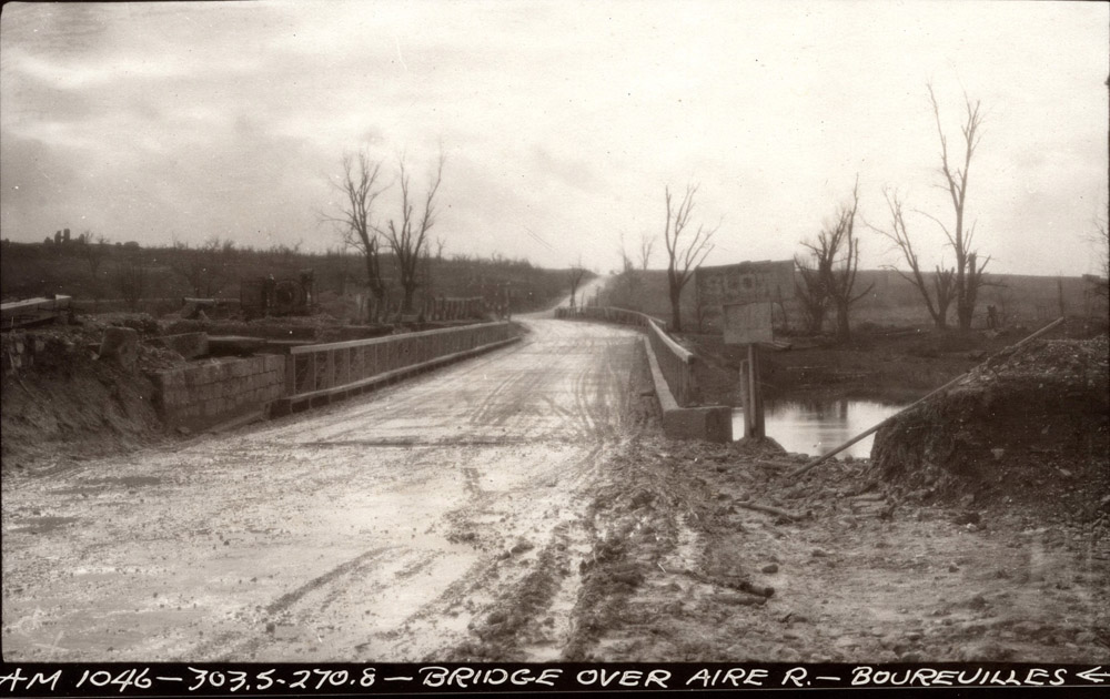
Photo taken September 28, 1918, 11am
Caption reads:
"American traffic crossing bridge hastily repaired by Co A and E, 103rd Regt Engineers."
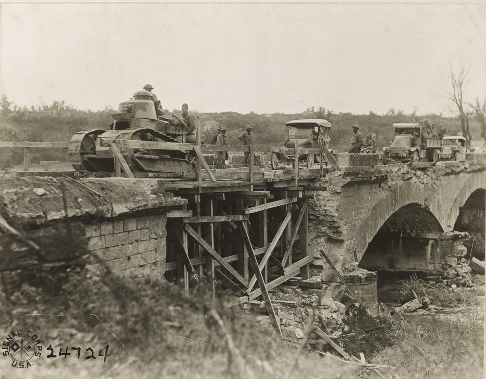
Photo Taken September 28, 1918, 11am
Caption reads:
"Tank crossing bridge repaired by Cos. A and E, 103rd Regt Engineers."
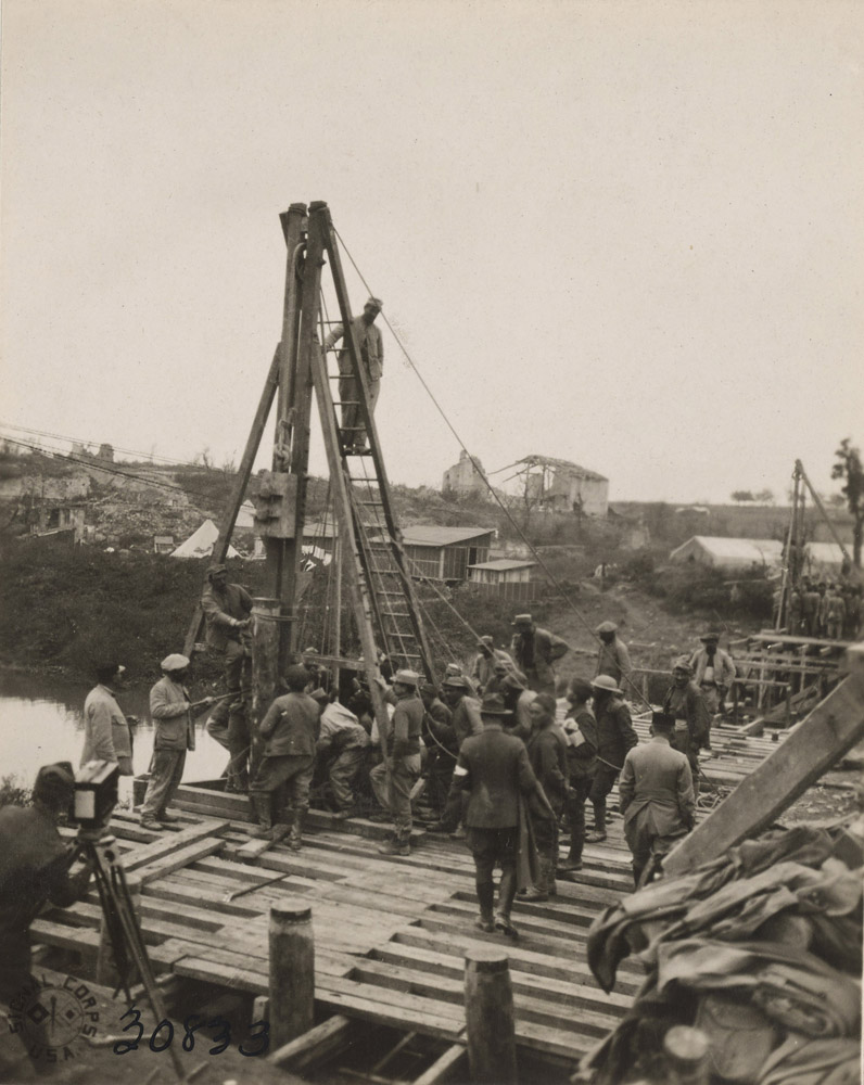
Photo taken October 25, 1918
A hand powered pile driver appears to be in use.
Caption reads:
"Building a bridge across the Aire River. This is the second
bridge to be built over the river, and it is being constructed by the
537th Engineers (colored), and the 4th French Engineers. The
first one was built entirely by the Americans. This bridge is to
take care of the heavy traffic to the front via Varennes."
This post war Griffin group photo shows the new wooden bridge with the
repaired stone one behind. The photo is from the north side and the
ruins of Boureuilles can be seen on the ridge behind.
Post war Griffin group photo looking south. The old bridge at
left seems to have construction equipment on it. The
offensive began on September 26th near where the road tops the ridge.
The southern mine crater was just over the top of the ridge.


The modern Route Nationale is beautiful and tree lined. The 28th
Division encountered resistance along a German defense line
perpindicular to the road.
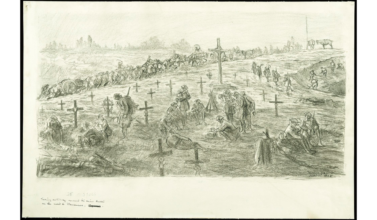
Second Mine Crater
An official Army artist depicted engineers using shovels to fill the mine crater.
Robert Stack wrote,
"On the second day of the drive we were
somewhat relieved when we saw the traffic wending its way onward.
After being taken (from the first crater) one mile farther ahead
we were presented with conditions exctly similar to the one just
described, only that the fields on each side of this Crater had been
"mined" and it was not until a six-inch gun had been pulled onto one of
the well-laid mines, completely destroying the same and killing and
wounding several men, that these treacherous conditions were actually
discovered."
"The detour road in this case was to be built along the same lines of
construuction as the first one, but after excavation had been started
and the impossibility of receiving the large quantities of stone had at
last been realized, it was decided that a plank road should be built in
place of the Telford. By this means a two-way traffic road was
completed within twenty four hours, and it was relief, the most
appreciated relief, we had ever received when we saw the traffic
congestion unravel, the great streams of cannon, ammunition, rations
and everything war-going or war-making was pushed with utmost rapidity
to the Front."
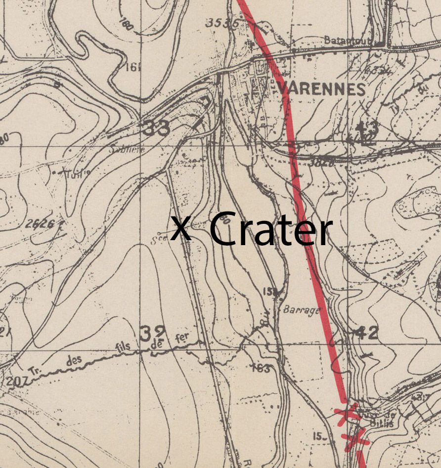
A photo from the Griffin group showing the bridge built over the crater
includes map coordinates so the precise location of the second crater
can be found - now a causeway over a wet weather stream. This
was an ideal location for the Germans to blow a mine crater, as
the road would be more difficult to repair at this location.
West Side of Crater Site
The detour road was built through these fields.
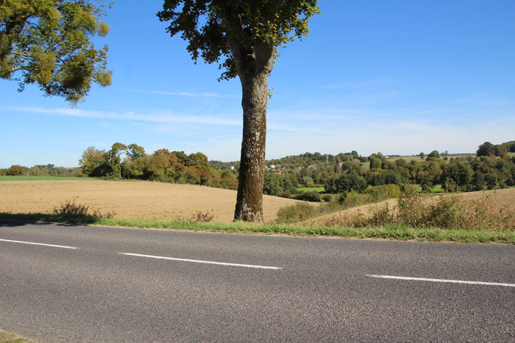
Looking east you can see that the ground descends in a ravine to the
Aire River. For this reason, the flatter terrain to the west was
better to construct a detour.
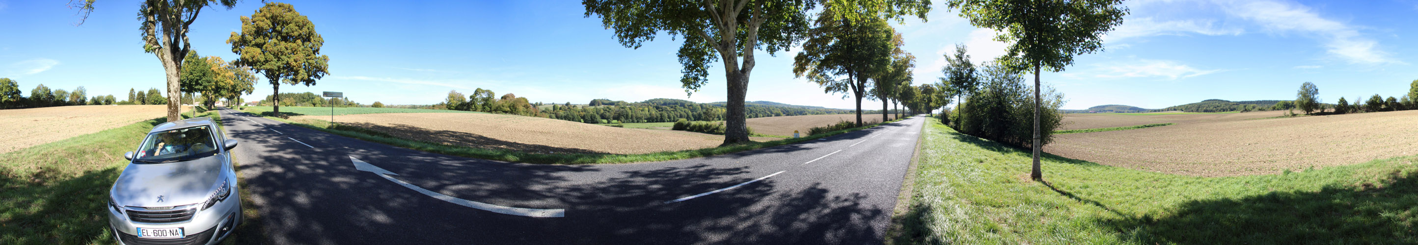
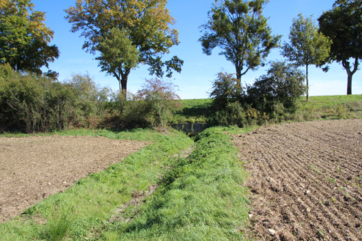
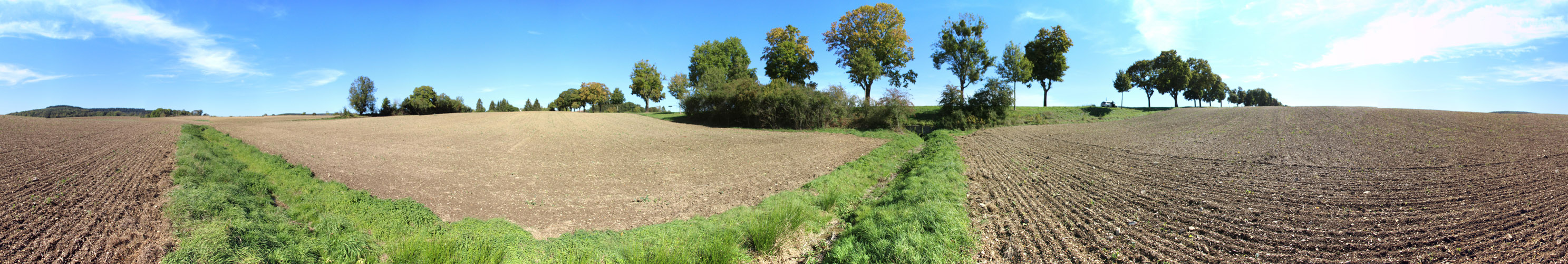
From just north of the crater location there is a great panorama of the
site. At left up the road is Varennes. At center the road
heads south to Boureuilles through the Aire River valley and high
ground including Butte Vauquois taken by the 35th Division can be seen.
A green strips of vegetation on either side of the road mark the
wet weather stream that passes under the road. This was the site
of the mine crater. In the fields at right a detour was built.
The high ground beyond the fields was taken by the 28th and 77th
Divisions. For details, see the section on the 28th Division.
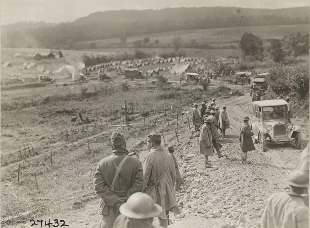
Robert Stack wrote,
"For the first, second, and third days
of the Drive, great numbers of these (wounded) men lay for hours
waiting for ambulances to carry them back to the Field Hospitals.
The only complaint we ever heard one of them utter was, "Why in
Hell don't you let that Artillery get up there and give the boys some
support?" "